MyTopo
Guilford New York US Topo Map
Couldn't load pickup availability
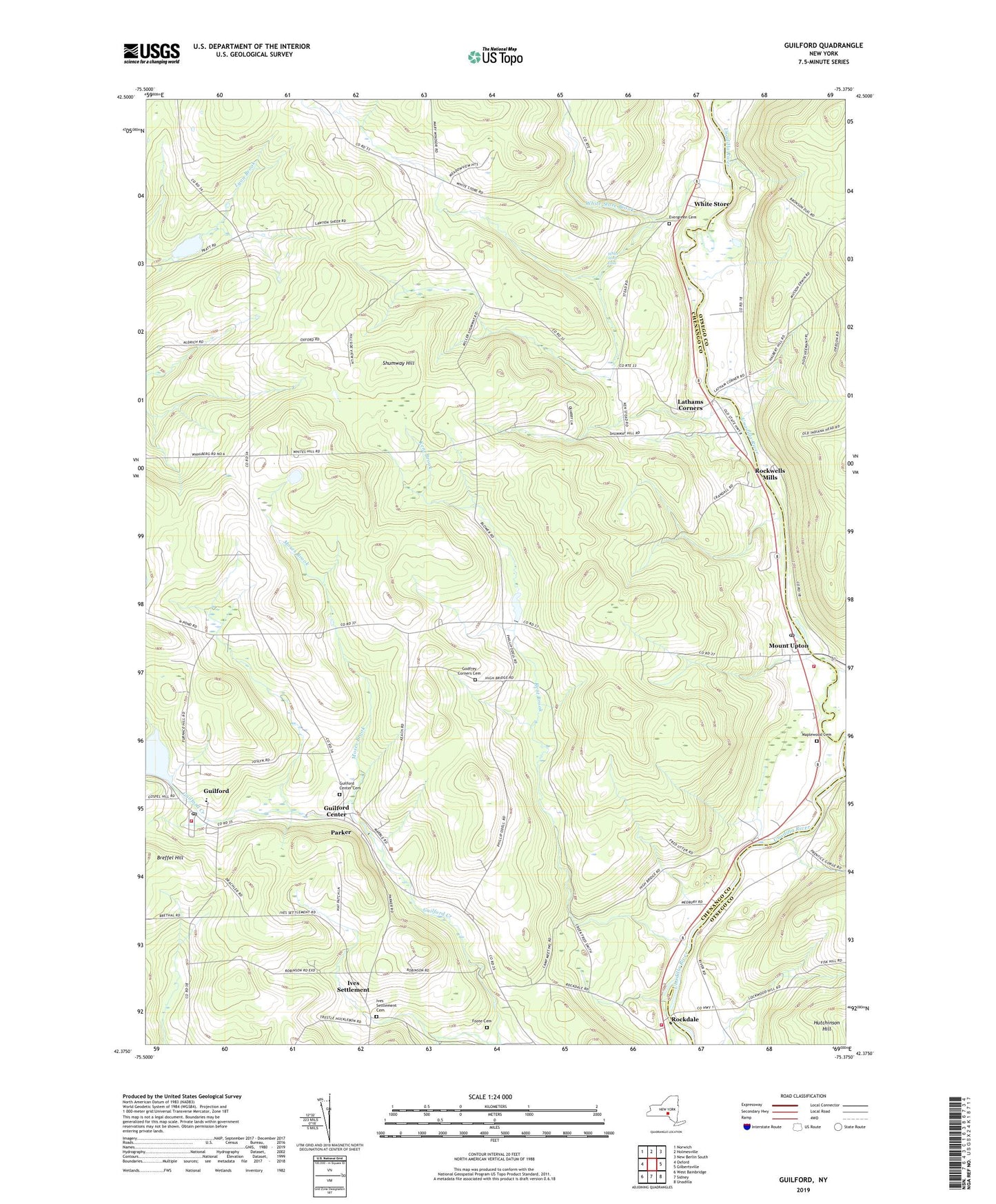
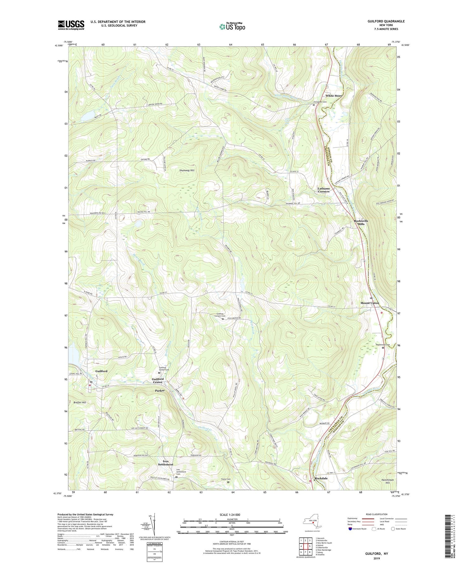
2019 topographic map quadrangle Guilford in the state of New York. Scale: 1:24000. Based on the newly updated USGS 7.5' US Topo map series, this map is in the following counties: Chenango, Otsego. The map contains contour data, water features, and other items you are used to seeing on USGS maps, but also has updated roads and other features. This is the next generation of topographic maps. Printed on high-quality waterproof paper with UV fade-resistant inks.
Quads adjacent to this one:
West: Oxford
Northwest: Norwich
North: Holmesville
Northeast: New Berlin South
East: Gilbertsville
Southeast: Unadilla
South: Sidney
Southwest: West Bainbridge
Contains the following named places: Borden Hose Company 1 Mount Upton Station, Borden Hose Company 1 Rockdale Station, Evergreen Cemetery, Foote Cemetery, Godfrey Corners, Godfrey Corners Cemetery, Guilford, Guilford Census Designated Place, Guilford Center, Guilford Center Cemetery, Guilford Elementary School, Guilford Lake, Guilford Post Office, Guilford United Methodist Church, Guilford Volunteer Fire Department, High Bridge, Ives Settlement, Ives Settlement Cemetery, Kent Brook, Lathams Corners, Maplewood Cemetery, Moses Brook, Mount Upton, Mount Upton Post Office, North Guilford Corners, Parker, Rockdale, Rockwells Mills, School Number 10, School Number 2, School Number 9, Shumway Hill, Town of Guilford, Trestle Corners, Webb Corners, White Store, White Store Brook, White Store Falls, Windsor Corners, ZIP Codes: 13780, 13809