MyTopo
New Berlin South New York US Topo Map
Couldn't load pickup availability
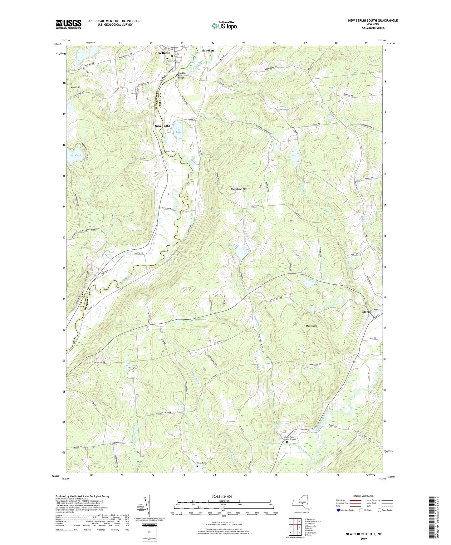
2023 topographic map quadrangle New Berlin South in the state of New York. Scale: 1:24000. Based on the newly updated USGS 7.5' US Topo map series, this map is in the following counties: Otsego, Chenango. The map contains contour data, water features, and other items you are used to seeing on USGS maps, but also has updated roads and other features. This is the next generation of topographic maps. Printed on high-quality waterproof paper with UV fade-resistant inks.
Quads adjacent to this one:
West: Holmesville
Northwest: Sherburne
North: New Berlin North
Northeast: Edmeston
East: Morris
Southeast: Otego
South: Gilbertsville
Southwest: Guilford
This map covers the same area as the classic USGS quad with code o42075e3.
Contains the following named places: All Saints Chapel, Allen Pond, Berean Baptist Church, Church Corners, Church of the Nazarene, Collier Bridge, Dakin Opera House, Davis Crossing, Deming School, Dimmick Hollow School, Dimock Hollow, Fairview Cemetery, Filer Corners, First Baptist Church, First United Methodist Church, Harris Hill, Hunt Pond, Hunt's Pond State Park, Johnson Farms, Mann Cemetery, Morris Brook, Morris Central School, Morris Family Burial Ground, Morris Pond, Morris Reservoir, New Berlin, New Berlin Central School, New Berlin Fire Department, New Berlin Library, New Berlin Municipal Building, New Berlin Post Office, New Eagle Hotel, Pickens Pond, Riverbend Golf Course, Sages Crossing, Saint Andrew's Cemetery, Saint Andrew's Episcopal Church, Saint Marys Falls, School Number 3, School Number 4, School Number 8, Scribner Cemetery, Shacktown Mountain, Silver Lake, Town of Morris, Town of Pittsfield, Unadilla River Bridge, Unadilla Valley Central School, Village of New Berlin, Waltzing Horse Farm, West Hill, Wharton Creek, Wheeler School, ZIP Code: 13808