MyTopo
Hubbardsville New York US Topo Map
Couldn't load pickup availability
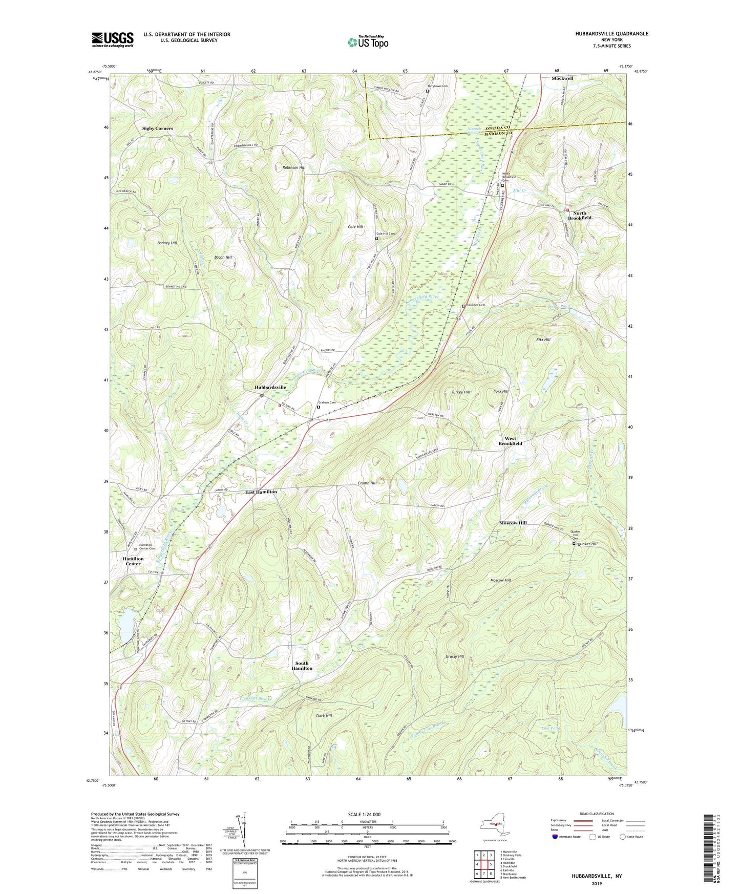
2019 topographic map quadrangle Hubbardsville in the state of New York. Scale: 1:24000. Based on the newly updated USGS 7.5' US Topo map series, this map is in the following counties: Madison, Oneida. The map contains contour data, water features, and other items you are used to seeing on USGS maps, but also has updated roads and other features. This is the next generation of topographic maps. Printed on high-quality waterproof paper with UV fade-resistant inks.
Quads adjacent to this one:
West: Hamilton
Northwest: Munnsville
North: Oriskany Falls
Northeast: Cassville
East: Brookfield
Southeast: New Berlin North
South: Sherburne
Southwest: Earlville
Contains the following named places: Bacon Hill, Barns Pond, Beaver Meadow School, Beekman Corners, Bonney Hill, Brooks Corner, Clark Hill, Cole Hill, Cole Hill Cemetery, Cole Hill School, Crumb Hill, Darts Corners, Durfee Corners, East Hamilton, Excell Corners, Faulkner Cemetery, Graham Cemetery, Grassy Hill, Hamilton Center, Hamilton Center Cemetery, Hubbardsville, Hubbardsville Post Office, Hubbardsville Volunteer Fire Department, Hunt Creek, Loomis Corners, Lost Pond, Marsh Corners, Mill Creek, Moscow Hill, Ninemile Swamp, North Brookfield, North Brookfield Cemetery, North Brookfield Volunteer Fire Department, Poolville Pond, Quaker Hill, Quaker Hill Cemetery, Ritz Hill, Robinson Hill, Rocky Top Acres, School Number 8, School Number 9, Sigby Corners, Snow Pond, South Hamilton, Stockwell, Tarrytown Cemetery, Tinker Hollow, Town of Hamilton, Turkey Hill, Union School, West Brookfield, York Hill, York Pond, ZIP Codes: 13355, 13418