MyTopo
Sherburne New York US Topo Map
Couldn't load pickup availability
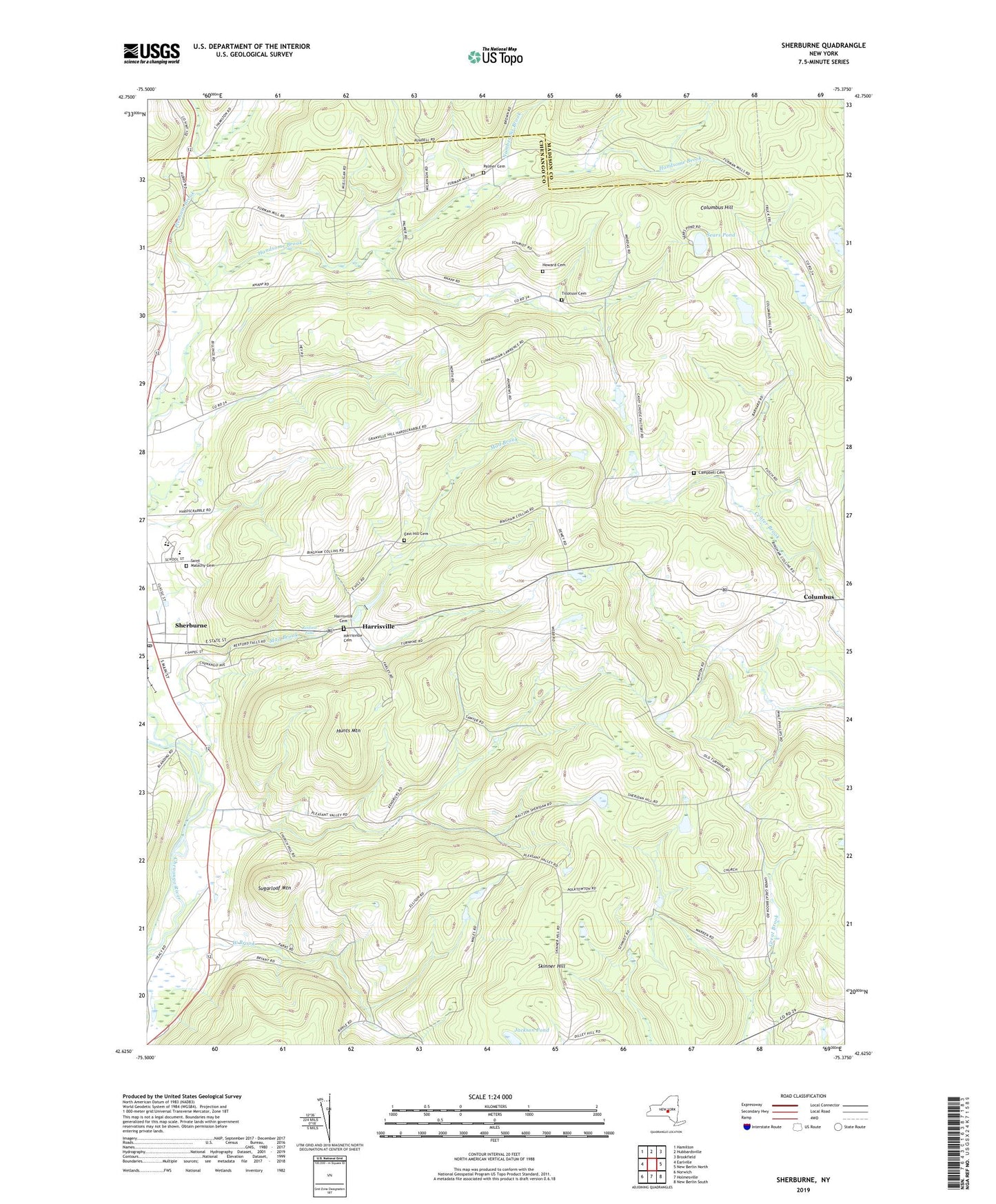
2023 topographic map quadrangle Sherburne in the state of New York. Scale: 1:24000. Based on the newly updated USGS 7.5' US Topo map series, this map is in the following counties: Chenango, Madison. The map contains contour data, water features, and other items you are used to seeing on USGS maps, but also has updated roads and other features. This is the next generation of topographic maps. Printed on high-quality waterproof paper with UV fade-resistant inks.
Quads adjacent to this one:
West: Earlville
Northwest: Hamilton
North: Hubbardsville
Northeast: Brookfield
East: New Berlin North
Southeast: New Berlin South
South: Holmesville
Southwest: Norwich
This map covers the same area as the classic USGS quad with code o42075f4.
Contains the following named places: Campbell Cemetery, Christ Episcopal Church, Christian Baptist Church, Columbus Hill, East Hill Cemetery, First Congregational Church, Harrisville, Harrisville Cemetery, Howard Cemetery, Hunts Mountain, Jackson Pond, Mad Brook, Mountain Top Golf Course, Negro Hollow, Negro Hollow Church, Number Six Brook, Palmer Cemetery, Pleasant Brook, Pratt - Newton Memorial Home, Rexford Falls, Saint Malachy Cemetery, Saint Malachy's Roman Catholic Church, School Number 1, School Number 11, School Number 12, School Number 13, School Number 15, School Number 5, School Number 6, Sears Pond, Sherburne, Sherburne - Earlville Elementary School, Sherburne - Earlville Middle School, Sherburne Baptist Church, Sherburne Central School, Sherburne Grange, Sherburne Post Office, Sherburne Public Library, Sherburne Senior Housing Center, Sherburne United Methodist Church, Sherburne-Earlville High School, Skinner Hill, Sugarloaf Mountain, Tillotson Cemetery, Town of Sherburne, Village of Sherburne, West Brook, ZIP Code: 13460