MyTopo
New Berlin North New York US Topo Map
Couldn't load pickup availability
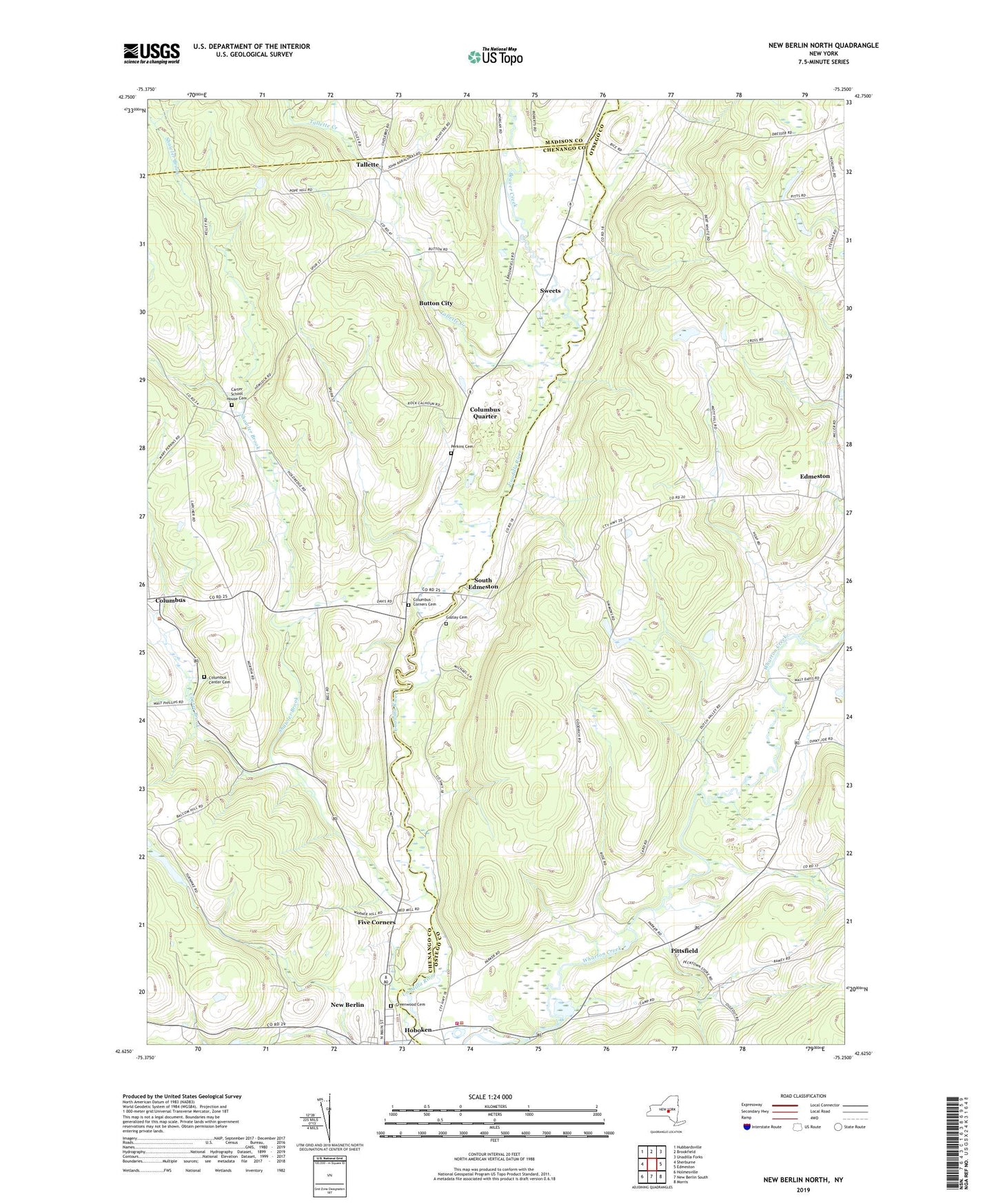
2023 topographic map quadrangle New Berlin North in the state of New York. Scale: 1:24000. Based on the newly updated USGS 7.5' US Topo map series, this map is in the following counties: Chenango, Otsego, Madison. The map contains contour data, water features, and other items you are used to seeing on USGS maps, but also has updated roads and other features. This is the next generation of topographic maps. Printed on high-quality waterproof paper with UV fade-resistant inks.
Quads adjacent to this one:
West: Sherburne
Northwest: Hubbardsville
North: Brookfield
Northeast: Unadilla Forks
East: Edmeston
Southeast: Morris
South: New Berlin South
Southwest: Holmesville
This map covers the same area as the classic USGS quad with code o42075f3.
Contains the following named places: Amblers Crossing, Beaver Creek, Briggs Corners, Button City, Carter School House Cemetery, Center Brook, Columbus, Columbus Center Cemetery, Columbus Corners Cemetery, Columbus Quarter, Edmeston Census Designated Place, Fairkit Farm, Five Corners, Gazlay Cemetery, Greenwood Cemetery, Hoboken, Hoboken Dam, Hopestead Hill Farm, Lambs Corners, Manchester Corners, Millers Corners, Peet Hook Pastures, Perkins Cemetery, Pittsfield, Pittsfield Volunteer Fire Department, Saint Theresa's Roman Catholic Church, School Number 9, Shawler Brook, South Edmeston, South Edmeston Census Designated Place, South Edmeston Community Church, Sweets, Tallette, Tallette Creek, The Town of New Berlin Police Department, Town of Columbus, Town of Edmeston, Town School Number 3, Town School Number 9, Tri County Airways, ZIP Code: 13411