MyTopo
La Fargeville New York US Topo Map
Couldn't load pickup availability
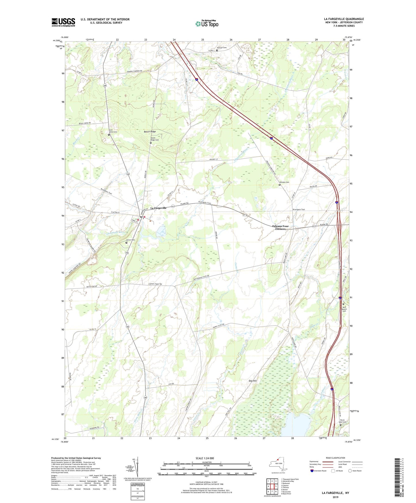
2019 topographic map quadrangle La Fargeville in the state of New York. Scale: 1:24000. Based on the newly updated USGS 7.5' US Topo map series, this map is in the following counties: Jefferson. The map contains contour data, water features, and other items you are used to seeing on USGS maps, but also has updated roads and other features. This is the next generation of topographic maps. Printed on high-quality waterproof paper with UV fade-resistant inks.
Quads adjacent to this one:
West: Clayton
Northwest: Thousand Island Park
North: Alexandria Bay
Northeast: Redwood
East: Theresa
Southeast: Black River
South: Brownville
Southwest: Dexter
Contains the following named places: Barlows Corners, Beech Ridge, Beech Ridge Cemetery, Collins Landing Northbound Rest Area, De La Farge Corners, Dog Hill, Grove Cemetery, Hinman Cemetery, Hyde Creek, La Fargeville, La Fargeville Census Designated Place, La Fargeville Central School, La Fargeville Fire Department Station 1, La Fargeville Fire Department Station 2, La Fargeville Post Office, La Fargeville Wastewater Treatment Facility, Lafargeville United Methodist Church, New Boston Cemetery, Orleans Cemetery, Orleans Four Corners, Orleans Public Library, Perch Lake Cemetery, Saint Johns Cemetery, School Number 18, School Number 20, Strough Corners, Tanners Corners, Tims Angus Farm Airport, Town of Orleans, Wall Haven Farms, ZIP Code: 13656