MyTopo
Redwood New York US Topo Map
Couldn't load pickup availability
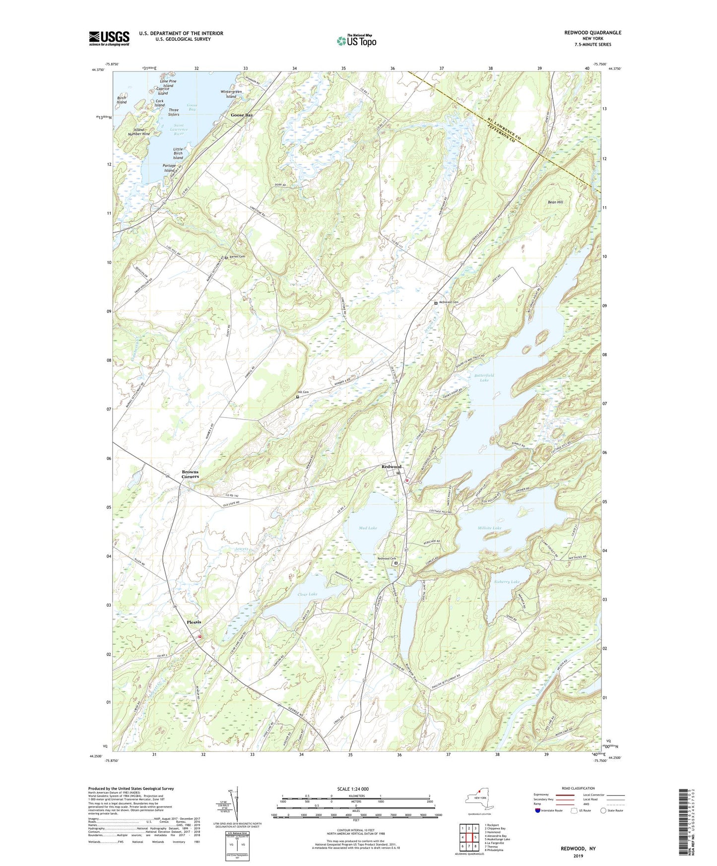
2023 topographic map quadrangle Redwood in the state of New York. Scale: 1:24000. Based on the newly updated USGS 7.5' US Topo map series, this map is in the following counties: Jefferson, St. Lawrence. The map contains contour data, water features, and other items you are used to seeing on USGS maps, but also has updated roads and other features. This is the next generation of topographic maps. Printed on high-quality waterproof paper with UV fade-resistant inks.
Quads adjacent to this one:
West: Alexandria Bay
Northwest: Rockport
North: Chippewa Bay
Northeast: Hammond
East: Muskellunge Lake
Southeast: Philadelphia
South: Theresa
Southwest: La Fargeville
This map covers the same area as the classic USGS quad with code o44075c7.
Contains the following named places: Barnes Cemetery, Bean Hill, Bean Hill Crossing, Birch Island, Browns Corners, Butterfield Lake, Caprice Island, Clear Lake, Cork Island, Cranberry Creek, Crystal Lake, Goose Bay, Hill Cemetery, Indian River Wildlife Management Area, Island Number Nine, Jewett Creek, Little Birch Island, Lone Pine Island, McDonald Cemetery, Millsite Lake, Mud Lake, Picnic Island, Plessis, Plessis Census Designated Place, Plessis Fire District, Portage Island, Redwood, Redwood Cemetery, Redwood Census Designated Place, Redwood Post Office, Redwood Sewage District Wastewater Treatment Plant, Redwood Volunteer Fire Department, Saint Paul's Lutheran Church, School Number 1, School Number 14, School Number 4, School Number 6, School Number 9, Sixberry Lake, Skinners Corners, Thousand Islands Christian Church, Three Sisters, Wintergreen Island, ZIP Codes: 13675, 13679