MyTopo
Lewis New York US Topo Map
Couldn't load pickup availability
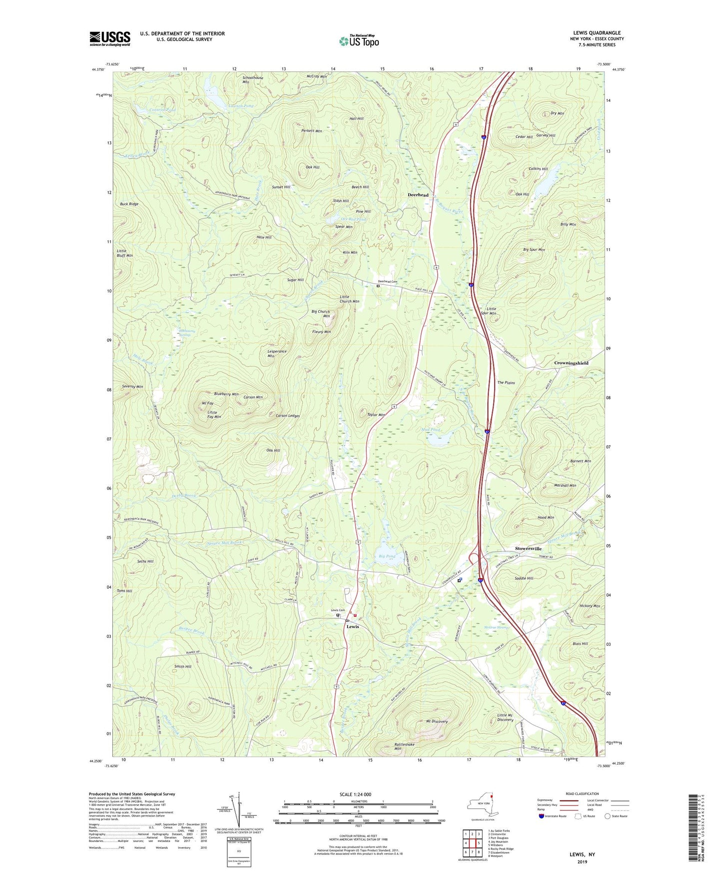
2019 topographic map quadrangle Lewis in the state of New York. Scale: 1:24000. Based on the newly updated USGS 7.5' US Topo map series, this map is in the following counties: Essex. The map contains contour data, water features, and other items you are used to seeing on USGS maps, but also has updated roads and other features. This is the next generation of topographic maps. Printed on high-quality waterproof paper with UV fade-resistant inks.
Quads adjacent to this one:
West: Jay Mountain
Northwest: Au Sable Forks
North: Clintonville
Northeast: Port Douglass
East: Willsboro
Southeast: Westport
South: Elizabethtown
Southwest: Rocky Peak Ridge
Contains the following named places: Barnett Mountain, Beech Hill, Big Church Mountain, Big Pond, Big Spur Mountain, Billy Mountain, Blais Hill, Blueberry Mountain, Burpee Brook, Calkins Hill, Carson Ledges, Carson Mountain, Cedar Hill, Church Brook, Coonrod Pond, Crowningshield, Deerhead, Deerhead Cemetery, Derby Brook, Dry Mountain, Essex County Sheriff's Office, Fleury Mountain, Frances Pond, Garvey Hill, Hale Hill, Hall Hill, Hathaway Swamp, Hickory Mountain, Hood Mountain, Kelley Brook, Kiln Mountain, Kingdom Hall of Jehovahs Witnesses, Lawson Pond, Lesperance Mountain, Lewis, Lewis Cemetery, Lewis Post Office, Lewis Quarry, Lewis Volunteer Fire Company, Little Church Mountain, Little Fay Mountain, Little Mount Discovery, Little Spur Mountain, Magic Pines Campground, Marshall Mountain, McGrae Swamp, Milholland Park, Mount Fay, Mount Inez, Mud Pond, Oak Hill, Ore Bed Pond, Perkett Mountain, Pine Hill, Rattlesnake Mountain, Saddle Hill, Schoolhouse Mountain, Seths Hill, Seventy Mountain, Slash Hill, Smith Hill, Spear Mountain, Stowersville, Sugar Hill, Sunset Hill, Taylor Mountain, The Plains, Thrall Dam Park, Town of Lewis, ZIP Code: 12950