MyTopo
Westport New York US Topo Map
Couldn't load pickup availability
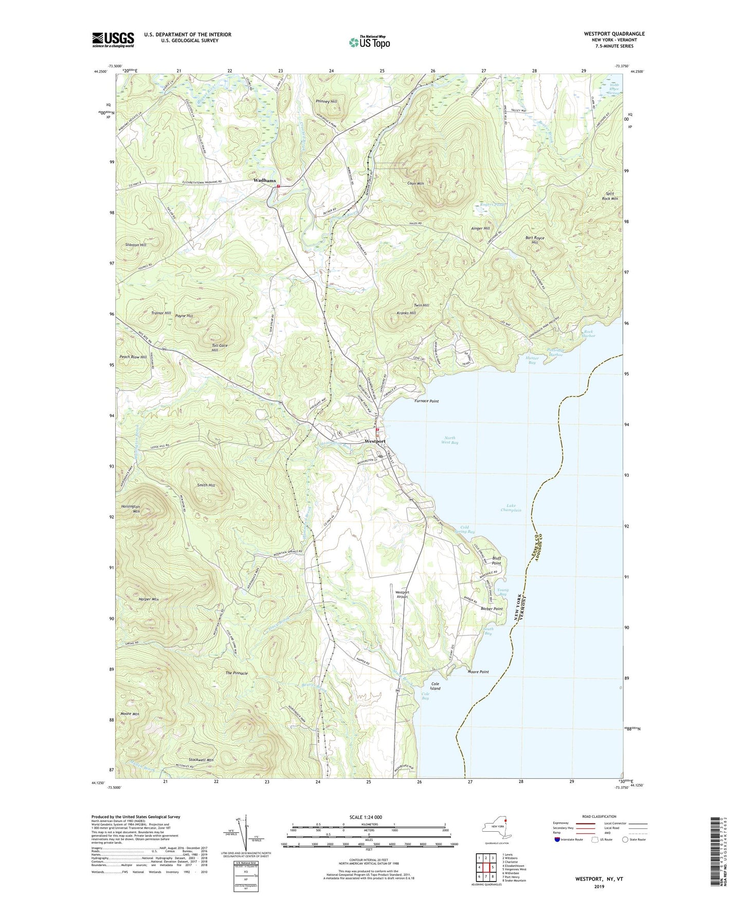
2023 topographic map quadrangle Westport in the state of New York. Scale: 1:24000. Based on the newly updated USGS 7.5' US Topo map series, this map is in the following counties: Essex, Addison. The map contains contour data, water features, and other items you are used to seeing on USGS maps, but also has updated roads and other features. This is the next generation of topographic maps. Printed on high-quality waterproof paper with UV fade-resistant inks.
Quads adjacent to this one:
West: Elizabethtown
Northwest: Lewis
North: Willsboro
Northeast: Charlotte
East: Vergennes West
Southeast: Snake Mountain
South: Port Henry
Southwest: Witherbee
Contains the following named places: Ainger Hill, Ainger Hill School, Barber Homestead Park, Barber Point, Barbers Point Lighthouse, Bart Royce Hill, Bluff Point, Camp Dudley, Cold Spring Bay, Cole Bay, Cole Island, Coon Mountain, Crooked Brook, French School, Furnace Point, Hammond Brook, Harper Mountain, Hoisington Brook, Hoisington Mountain, Hoisington School, Hunter Bay, Kronks Hill, Moore Mountain, Moore Point, North West Bay, Partridge Harbor, Payne Hill, Peach Blow Hill, Phinney Hill, Rock Harbor, Rogers Pond, Smith Hill, South Bay, Stacy Brook, Stanton Hill, Stockwell Mountain, The Pinnacle, Toll Gate Hill, Town of Westport, Trainor Hill, Twin Hill, Wadhams, Wadhams Free Library, Wadhams Sewer District Number 1 Wastewater Treatment Plant, Wadhams Volunteer Fire Company, Westport, Westport Airport, Westport Census Designated Place, Westport Country Club, Westport Federated Church, Westport Hose Company 1, Westport Library Association, Westport Post Office, Young Bay, ZIP Code: 12993