MyTopo
Rocky Peak Ridge New York US Topo Map
Couldn't load pickup availability
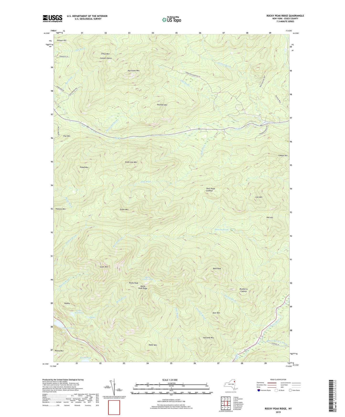
2023 topographic map quadrangle Rocky Peak Ridge in the state of New York. Scale: 1:24000. Based on the newly updated USGS 7.5' US Topo map series, this map is in the following counties: Essex. The map contains contour data, water features, and other items you are used to seeing on USGS maps, but also has updated roads and other features. This is the next generation of topographic maps. Printed on high-quality waterproof paper with UV fade-resistant inks.
Quads adjacent to this one:
West: Keene Valley
Northwest: Keene
North: Jay Mountain
Northeast: Lewis
East: Elizabethtown
Southeast: Witherbee
South: Underwood
Southwest: Dix Mountain
Contains the following named places: Bald Peak, Bear Brook, Beaver Meadow Brook, Blueberry Cobbles, Chapel Pond, Chase Mountain, Conners Notch, Coughlin Brook, Deer Mountain, Dipper, Falls Brook, Flat Mountain, Giant Mountain, Giant Washbowl, Green Mountain, Holcomb Mountain, Hopkins Mountain, Hurricane Mountain, Iron Mountain, Jackson Brook, Jackson Hill, Knob Lock Mountain, Marie Louise Pond, Noble Mountain, Nubble, Oak Hill, Owls Head Lookout, Pitchoff Mountain, Rocky Peak, Rocky Peak Ridge, Slide Brook, Split Rock Falls, Stevens Brook, Tripod Mountain, ZIP Code: 12964