MyTopo
Lexington New York US Topo Map
Couldn't load pickup availability
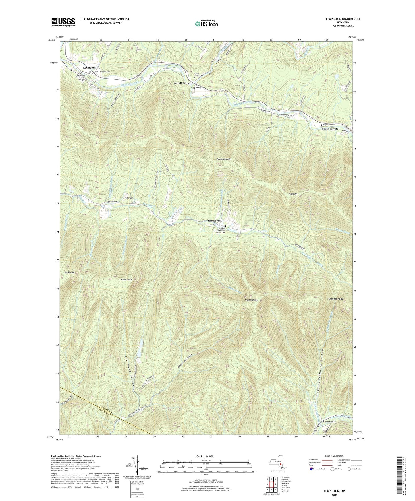
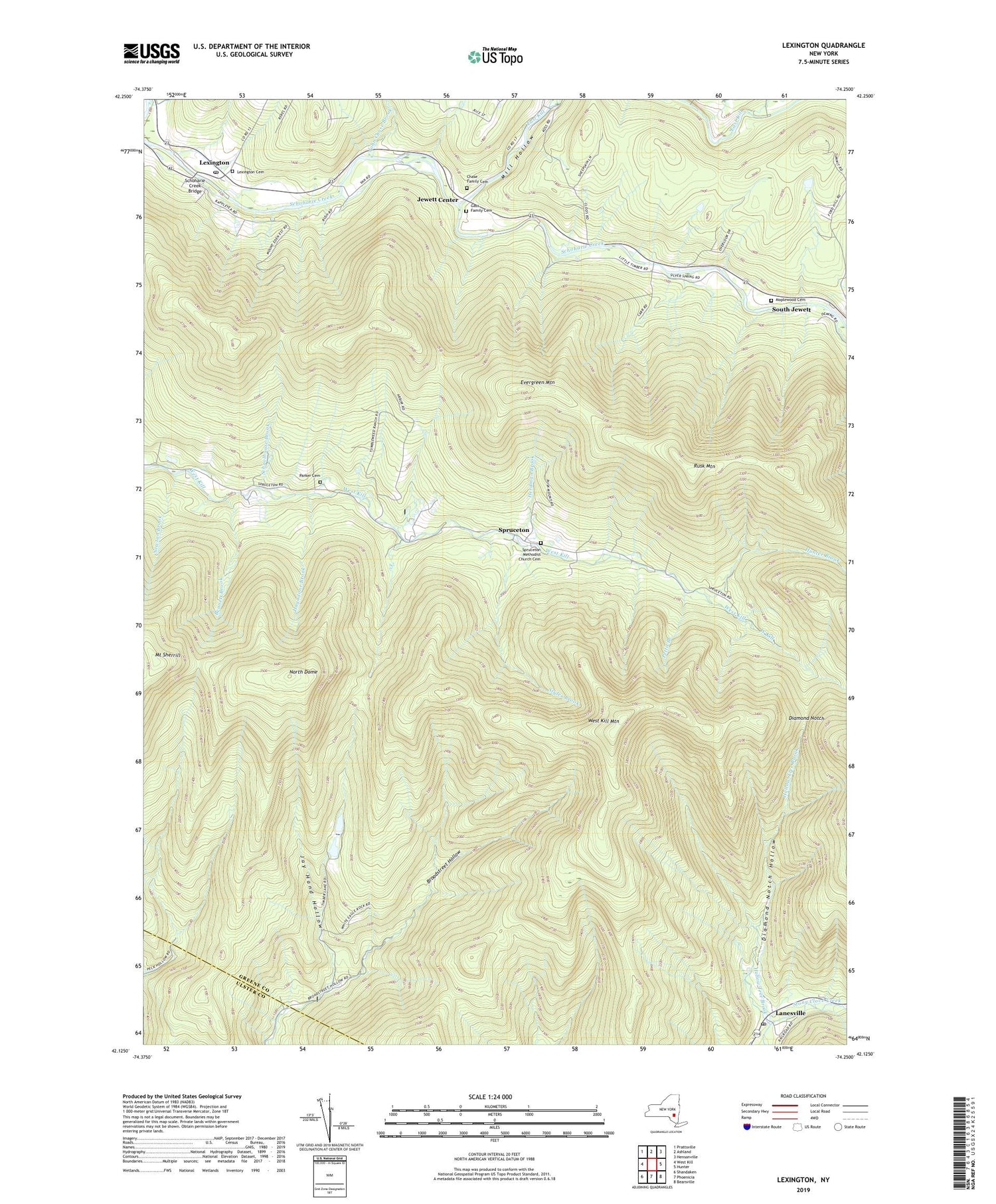
2019 topographic map quadrangle Lexington in the state of New York. Scale: 1:24000. Based on the newly updated USGS 7.5' US Topo map series, this map is in the following counties: Greene, Ulster. The map contains contour data, water features, and other items you are used to seeing on USGS maps, but also has updated roads and other features. This is the next generation of topographic maps. Printed on high-quality waterproof paper with UV fade-resistant inks.
Quads adjacent to this one:
West: West Kill
Northwest: Prattsville
North: Ashland
Northeast: Hensonville
East: Hunter
Southeast: Bearsville
South: Phoenicia
Southwest: Shandaken
Contains the following named places: Bennett Brook, Broadstreet School, Camp Delmar, Chase Family Cemetery, Diamond Notch, Diamond Notch Hollow, East Kill, Evergreen Mountain, Gass Family Cemetery, Hagadone Brook, Herdman Brook, Hollow Tree Brook, Hunter Brook, Jay Hand Hollow, Jewett Center, John Chase Brook, Lanesville, Lanesville Post Office, Lexington, Lexington Cemetery, Lexington Post Office, Maplewood Cemetery, Mill Hollow, Mink Hollow, Mount Sherrill, Newton Brook, North Dome, Ox Hollow, Parker Cemetery, Pettit Branch, Rusk Mountain, Schoharie Creek Bridge, Schoolhouse Brook, South Jewett, Spruceton, Spruceton Methodist Church Cemetery, Styles Brook, Town of Lexington, West Kill Mountain, ZIP Code: 12492