MyTopo
Ashland New York US Topo Map
Couldn't load pickup availability
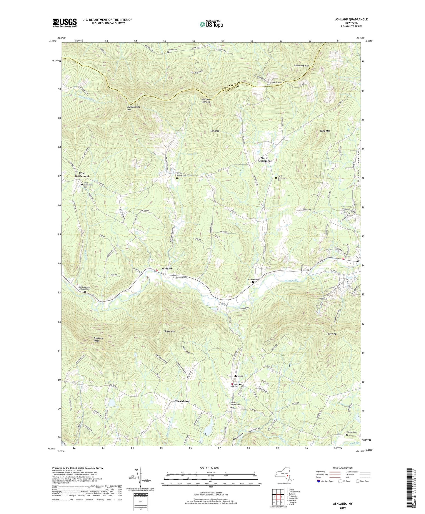
2023 topographic map quadrangle Ashland in the state of New York. Scale: 1:24000. Based on the newly updated USGS 7.5' US Topo map series, this map is in the following counties: Greene, Schoharie. The map contains contour data, water features, and other items you are used to seeing on USGS maps, but also has updated roads and other features. This is the next generation of topographic maps. Printed on high-quality waterproof paper with UV fade-resistant inks.
Quads adjacent to this one:
West: Prattsville
Northwest: Gilboa
North: Livingstonville
Northeast: Durham
East: Hensonville
Southeast: Hunter
South: Lexington
Southwest: West Kill
This map covers the same area as the classic USGS quad with code o42074c3.
Contains the following named places: Ashland, Ashland Cemetery, Ashland Community United Methodist Church, Ashland Fire Department, Ashland Pinnacle, Ashland Post Office, Bald Mountain Tree Farm, Bump Mountain, Central School, Freese Cemetery, Hull - Peck Cemetery, Huntersfield Mountain, Jewett, Jewett Fire Department, Jewett Heights Cemetery, Jewett Post Office, Kerns Nursery, Lewis Creek, Mitchell Hollow, North Settlement, North Settlement Cemetery, North Settlement United Methodist Church, Richmond Mountain, Roaring Brook, Saint Joseph's Chapel, Saint Joseph's Chapel Cemetery, School Number 3, School Number 5, School Number 6, School Number 7, South Mountain, Sutton Hollow, Sutton Hollow Cemetery, The Knob, Tower Mountain, Town of Ashland, Towner Cemetery, West Jewett, West Settlement, West Settlement Cemetery, Windham, Windham Fire Department, Windham Post Office, Windham Public Library, Windham Ski Area, ZIP Codes: 12407, 12444, 12452, 12496