MyTopo
West Kill New York US Topo Map
Couldn't load pickup availability
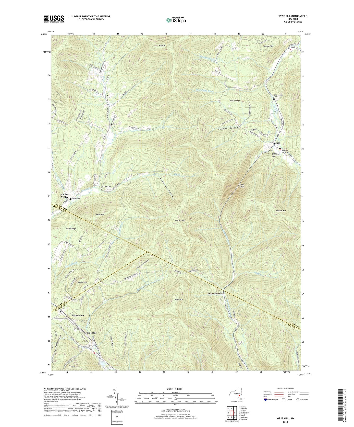
2023 topographic map quadrangle West Kill in the state of New York. Scale: 1:24000. Based on the newly updated USGS 7.5' US Topo map series, this map is in the following counties: Greene, Ulster, Delaware. The map contains contour data, water features, and other items you are used to seeing on USGS maps, but also has updated roads and other features. This is the next generation of topographic maps. Printed on high-quality waterproof paper with UV fade-resistant inks.
Quads adjacent to this one:
West: Fleischmanns
Northwest: Roxbury
North: Prattsville
Northeast: Ashland
East: Lexington
Southeast: Phoenicia
South: Shandaken
Southwest: Seager
This map covers the same area as the classic USGS quad with code o42074b4.
Contains the following named places: Angle Creek, Balsam Mountain, Beech Ridge, Beech Ridge Brook, Bushnellsville, Cathedral Glen, Condon Hollow, Crosby Cemetery, Deep Notch, Elk Creek, Elk Creek Cemetery, Gilead Tree Farm, Halcott Cemetery, Halcott Center, Halcott Mountain, Halcott School, Hemlock Gully, Highmount, Highmount Post Office, Hunter Tannersville Central School, Johnson Hollow, Lexington Volunteer Fire Department Station 1, Lexington Volunteer Fire Department Station 2, Monka Hill, Pine Hill, Pine Hill Census Designated Place, Pine Hill Fire Company 1, Pine Hill Post Office, Roarback Brook, Rose Mountain, Schermerhorn Cemetery, School Number 13, School Number 2, School Number 4, School Number 5, Si Meade Hollow, South Mountain, Stanton Hollow, Town of Halcott, Turk Hollow, Vinegar Hill, Vly Mountain, West Kill, West Kill Census Designated Place, West Kill Methodist Church Cemetery, West Kill Post Office, West Settlement Creek, Westkill Community Cemetery, ZIP Codes: 12430, 12465, 12480