MyTopo
Lisle New York US Topo Map
Couldn't load pickup availability
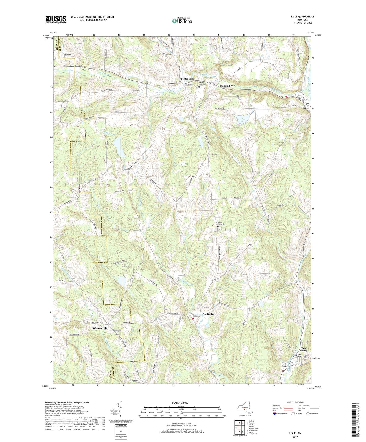
2019 topographic map quadrangle Lisle in the state of New York. Scale: 1:24000. Based on the newly updated USGS 7.5' US Topo map series, this map is in the following counties: Broome, Tioga. The map contains contour data, water features, and other items you are used to seeing on USGS maps, but also has updated roads and other features. This is the next generation of topographic maps. Printed on high-quality waterproof paper with UV fade-resistant inks.
Quads adjacent to this one:
West: Richford
Northwest: Harford
North: Marathon
Northeast: Willet
East: Whitney Point
Southeast: Castle Creek
South: Maine
Southwest: Newark Valley
Contains the following named places: Center Lisle, Center Lisle Cemetery, Christian Fellowship Church, Culver Creek, Dudley Creek, Fire Fox Golf Course, Glen Aubrey, Glen Aubrey Cemetery, Glen Aubrey Census Designated Place, Glen Aubrey Fire Company, Glen Aubrey Post Office, Grandview Farms Golf Course, Greenmuns Tree Farm, Ketchumville, Ketchumville Cemetery, Lisle, Lisle Associated Church, Lisle Fire Company, Lisle Free Library, Lisle Post Office, Manningville, Mount Hunger Cemetery, Nanticoke, Nanticoke Volunteer Fire Department, Sunny Hill Farm, Taylor Lisle Pit, Town of Lisle, Town of Nanticoke, Vandeburg Farms, Village of Lisle, ZIP Code: 13797