MyTopo
Newark Valley New York US Topo Map
Couldn't load pickup availability
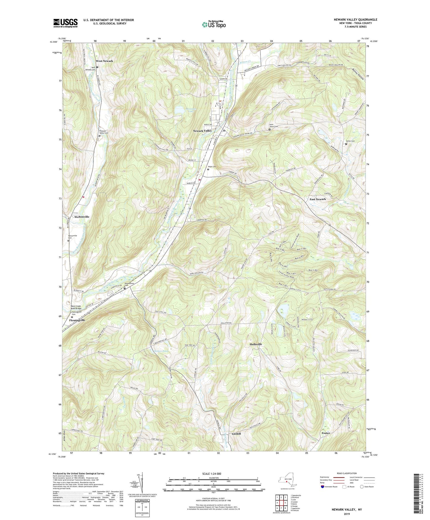
2023 topographic map quadrangle Newark Valley in the state of New York. Scale: 1:24000. Based on the newly updated USGS 7.5' US Topo map series, this map is in the following counties: Tioga. The map contains contour data, water features, and other items you are used to seeing on USGS maps, but also has updated roads and other features. This is the next generation of topographic maps. Printed on high-quality waterproof paper with UV fade-resistant inks.
Quads adjacent to this one:
West: Candor
Northwest: Speedsville
North: Richford
Northeast: Lisle
East: Maine
Southeast: Endicott
South: Apalachin
Southwest: Owego
This map covers the same area as the classic USGS quad with code o42076b2.
Contains the following named places: Alexander Lake, Doolittle Creek, East Beecher Hill Community Club, East Newark, First Baptist Church, First Congregational Church of Christ, First United Methodist Church of Newark Valley, Flemingville, Flemingville Cemetery, Flemingville United Methodist Church, Foster, Gaskill, Holden Pond, Hope Cemetery, Hullsville, Nathan T Hall Elementary School, Newark Valley, Newark Valley Depot Museum, Newark Valley Fire Department, Newark Valley Middle School, Newark Valley Post Office, Newark Valley Senior High School, Newark Valley Village Green, Northern Tioga Family Health Center, Oakley Corners, Oakley Corners State Forest, Pleasant Valley Cemetery, Saint John The Evangelist Church, Saint Johns Cemetery, Saint Maximus Orthodox Christian Church, Searlestown Cemetery, Settle Cemetery, Spencer - Kozanosky Pit, Tappan - Spaulding Memorial Library, Town of Newark Valley, Tri-K Farms, Trout Ponds Park, Valley Mobile Home Park, Village of Newark Valley, Weltonville, Weltonville Cemetery, Weltonville Fire Company, West Creek Church, West Creek Road Bridge, West Newark, West Newark Cemetery, Wilson Creek, ZIP Code: 13811