MyTopo
Northport New York US Topo Map
Couldn't load pickup availability
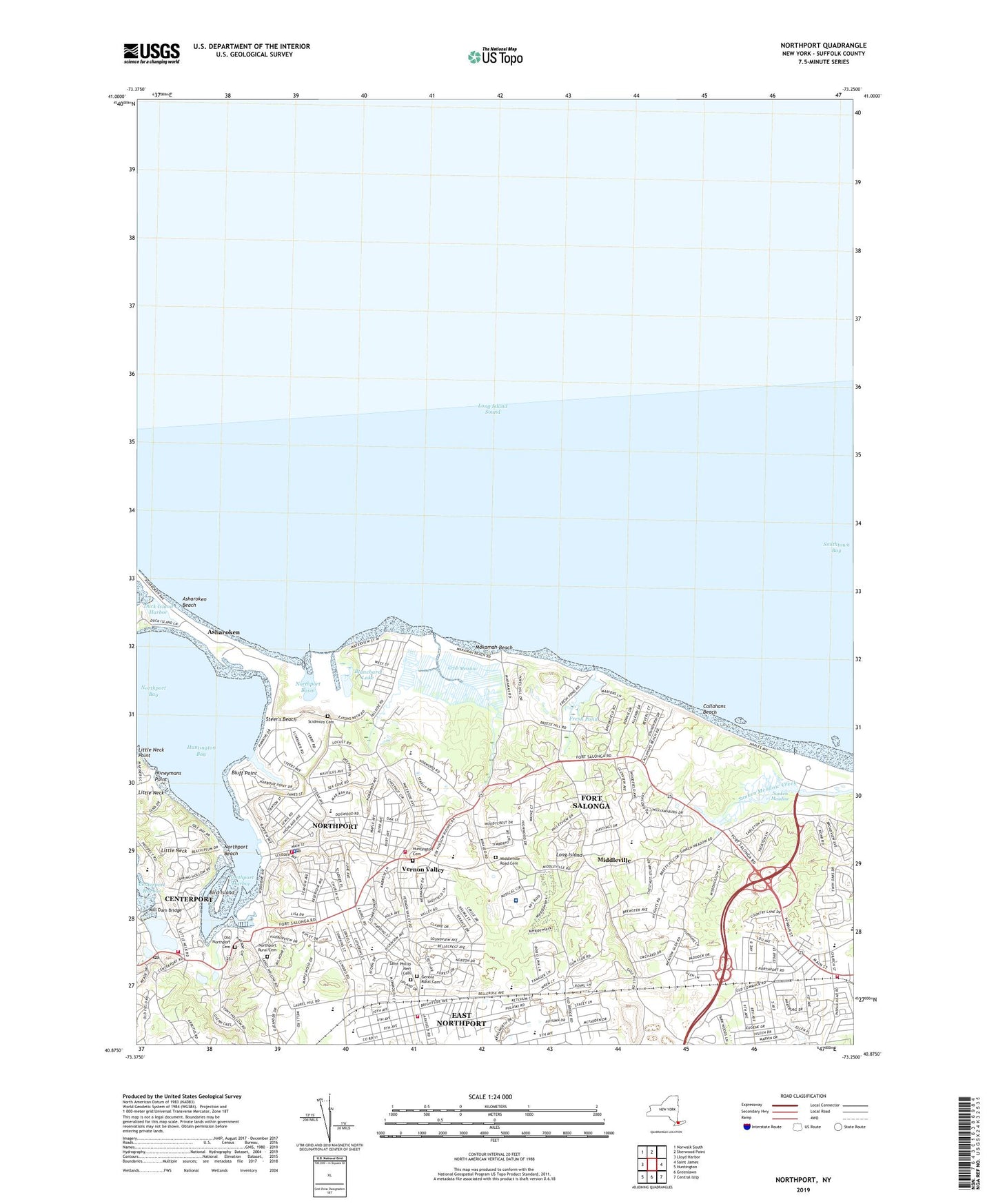
2019 topographic map quadrangle Northport in the state of New York. Scale: 1:24000. Based on the newly updated USGS 7.5' US Topo map series, this map is in the following counties: Suffolk. The map contains contour data, water features, and other items you are used to seeing on USGS maps, but also has updated roads and other features. This is the next generation of topographic maps. Printed on high-quality waterproof paper with UV fade-resistant inks.
Quads adjacent to this one:
West: Lloyd Harbor
Northwest: Norwalk South
North: Sherwood Point
East: Saint James
Southeast: Central Islip
South: Greenlawn
Southwest: Huntington
Contains the following named places: Asharoken, Asharoken Beach, Atria East Northport, Betty Allen Twin Ponds Nature Park, Bird Island, Blanchard Lake, Bluff Point, Callahans Beach, Callahan's Beach Park, Centerport Census Designated Place, Centerport Fire Department, Centerport Methodist Church, Centerport Post Office, Centerport School, Crab Meadow, Crab Meadow Beach Park, Crab Meadow Golf Course, Crab Meadow Park, East Northport, East Northport Census Designated Place, East Northport Christian Church, East Northport Fire Department, East Northport School, Fairlawn Adult Home, Fifth Avenue Elementary School, First Church of Christ Scientist, First Presbyterian Church, Fort Salonga, Fort Salonga Census Designated Place, Fort Salonga Elementary School, Fresh Pond, Genola Rural Cemetery, Henry Steers Gravel Pit, Honeymans Point, Huntington Cemetery, Indian Hills Country Club, Kings Park, Kings Park Adult Home, Kings Park Central High School, Kings Park Station, Kings Park Volunteer Fire Department, Larkfield School, Laurel Avenue Junior High School, Little Neck, Lutheran Church of the Abiding, Makamah Beach, Middleville, Middleville Road Cemetery, Mill Dam Bridge, Mill Pond, Northport, Northport - East Northport Public Library, Northport Basin, Northport Bay, Northport Beach, Northport Golf Course, Northport Harbor, Northport High School, Northport Middle School, Northport Park, Northport Post Office, Northport Power Station, Northport Public Library, Northport Rural Cemetery, Northport Station, Northport Veterans Affairs Medical Center, Northport Village Hall, Northport Village Police Department, Northport Volunteer Fire Department Headquarters, Northport Volunteer Fire Department Station 1, Northport Yacht Club, Norwood Road School, Ocean Avenue School, Old Northport Cemetery, Opcathontyche, Our Lady Queen of Martyrs Church, Pulaski Road School, Richters Orchards, Saint Josephs Church, Saint Josephs School, Saint Paul's Lutheran Church, Saint Paul's Methodist Church, Saint Philip Neri Roman Catholic Church, Saint Phillip Neri Cemetery, Saint Phillip Neri School, Scidmore Cemetery, Smithtown Bay, Smithtown Library Kings Park Branch, Steer's Beach, Steer's Park, Sunken Meadow, Sunken Meadow Creek Bridge, Sunken Meadow State Park, Sunken Meadow State Park Golf Course, Trinity Episcopal Church, Union Church, VAMC Heliport, Vanderbilt Museum, Vernon Valley, Village of Northport, William T Rogers Middle School, ZIP Codes: 11721, 11768