MyTopo
Number Four New York US Topo Map
Couldn't load pickup availability
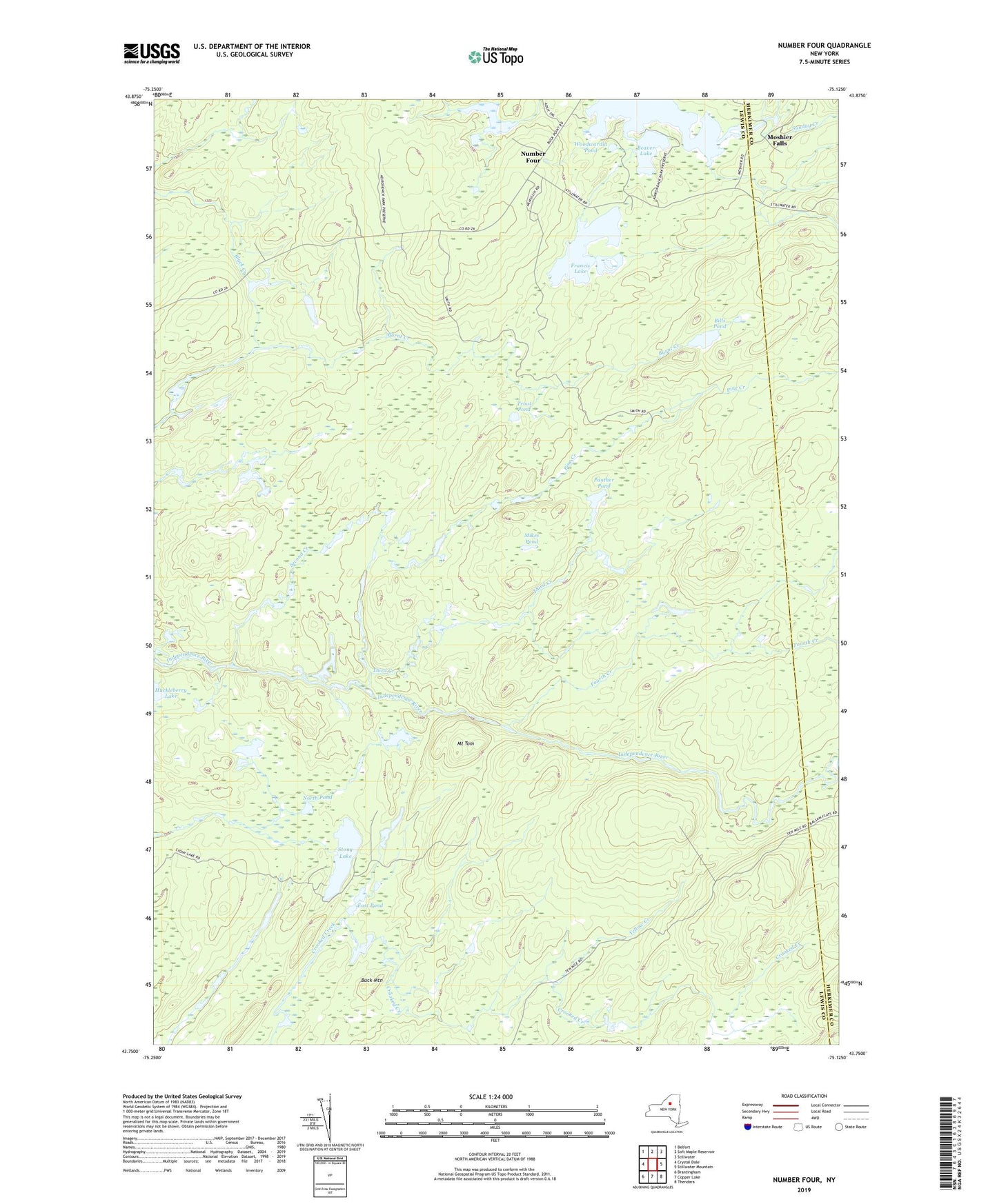
2019 topographic map quadrangle Number Four in the state of New York. Scale: 1:24000. Based on the newly updated USGS 7.5' US Topo map series, this map is in the following counties: Lewis, Herkimer. The map contains contour data, water features, and other items you are used to seeing on USGS maps, but also has updated roads and other features. This is the next generation of topographic maps. Printed on high-quality waterproof paper with UV fade-resistant inks.
Quads adjacent to this one:
West: Crystal Dale
Northwest: Belfort
North: Soft Maple Reservoir
Northeast: Stillwater
East: Stillwater Mountain
Southeast: Thendara
South: Copper Lake
Southwest: Brantingham
Contains the following named places: Beaver Lake, Bills Pond, Buck Mountain, East Pond, Fifth Creek, Fourth Creek, Francis Lake, Huckleberry Lake, Mikes Pond, Moshier Falls, Mount Tom, North Pond, Number Four, Panther Pond, Pine Creek, Second Creek, Stony Lake, Sunday Creek, Third Creek, Trout Pond, Woodwardia Pond, Yellow Creek