MyTopo
Soft Maple Reservoir New York US Topo Map
Couldn't load pickup availability
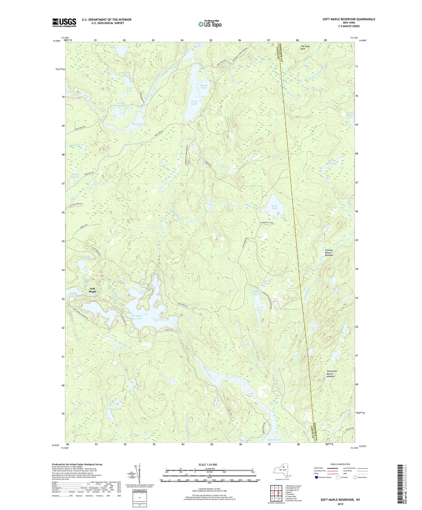
2023 topographic map quadrangle Soft Maple Reservoir in the state of New York. Scale: 1:24000. Based on the newly updated USGS 7.5' US Topo map series, this map is in the following counties: Lewis, Herkimer. The map contains contour data, water features, and other items you are used to seeing on USGS maps, but also has updated roads and other features. This is the next generation of topographic maps. Printed on high-quality waterproof paper with UV fade-resistant inks.
Quads adjacent to this one:
West: Belfort
Northwest: Remington Corners
North: Oswegatchie SW
Northeast: Oswegatchie SE
East: Stillwater
Southeast: Stillwater Mountain
South: Number Four
Southwest: Crystal Dale
Contains the following named places: Alder Creek, Beaver Meadow Brook, Clear Pond, Cowboy Beaver Meadow, Crooked Lake, Desert Creek, Eagle Falls, Fish Creek, French Pond, Hogs Back Creek, Jakes Pond, Lanes Pond, Long Pond, McCabe Pond, Meister Pond, Mud Pond, Pepperbox Creek, Roaring Brook, Rock Pond, Round Pond, Sammys Creek, Sand Pond, Snider Pond, Soft Maple, Soft Maple Reservoir, Spring Pond, The Hogs Back, Threemile Beaver Meadow, Twin Ponds, West Ponds