MyTopo
Thendara New York US Topo Map
Couldn't load pickup availability
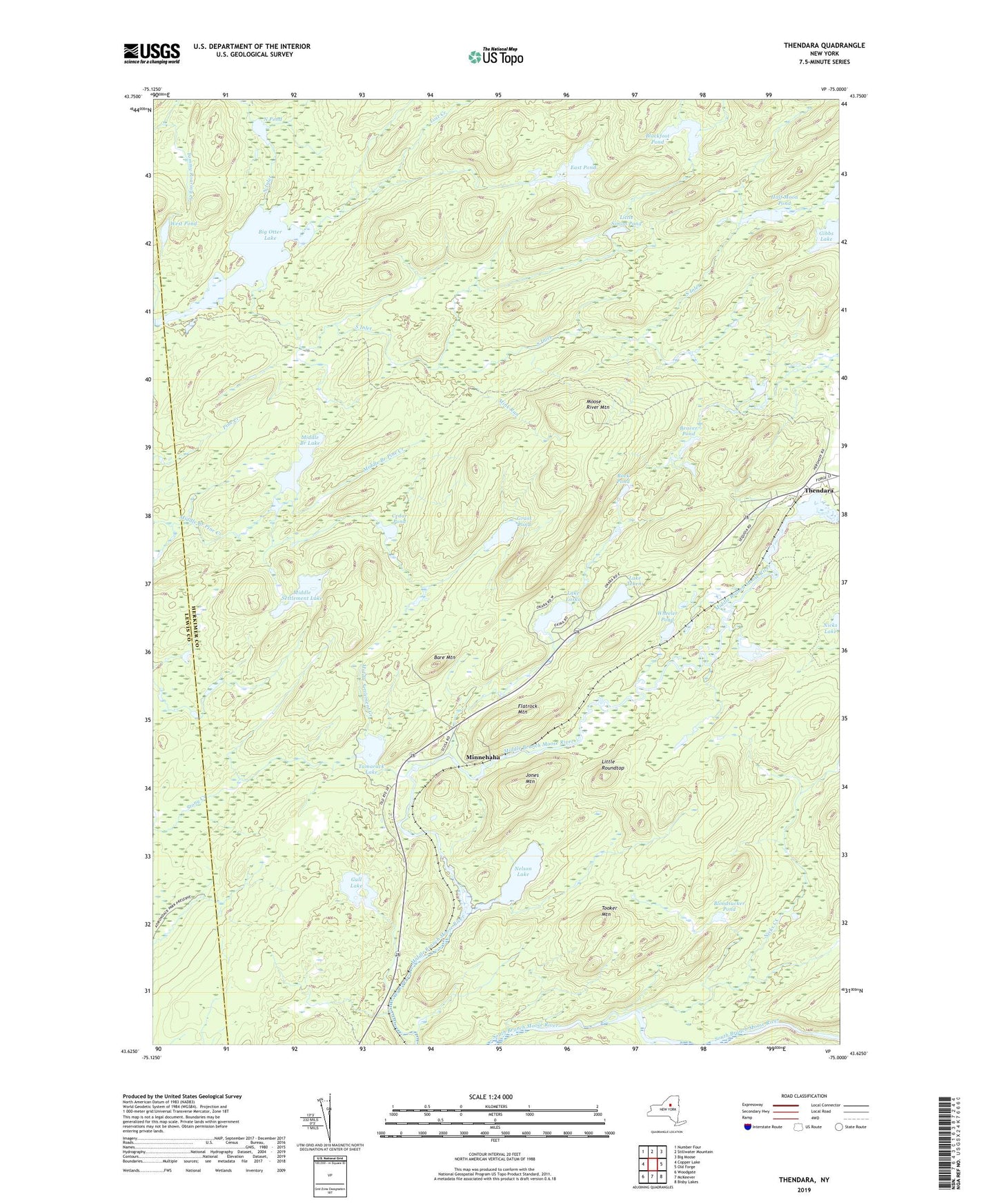
2023 topographic map quadrangle Thendara in the state of New York. Scale: 1:24000. Based on the newly updated USGS 7.5' US Topo map series, this map is in the following counties: Herkimer, Lewis. The map contains contour data, water features, and other items you are used to seeing on USGS maps, but also has updated roads and other features. This is the next generation of topographic maps. Printed on high-quality waterproof paper with UV fade-resistant inks.
Quads adjacent to this one:
West: Copper Lake
Northwest: Number Four
North: Stillwater Mountain
Northeast: Big Moose
East: Old Forge
Southeast: Bisby Lakes
South: McKeever
Southwest: Woodgate
This map covers the same area as the classic USGS quad with code k43075f1.
Contains the following named places: Bare Mountain, Beaver Pond, Big Otter Lake, Blackfoot Pond, Bloodsucker Pond, Cedar Pond, East Pond, Flatrock Mountain, Gibbs Lake, Grass Pond, Gull Lake, Haderondah Wilderness, Half Moon Pond, Indian Brook, Jones Mountain, Lake Easka, Lake Tekeni, Little Roundtop, Little Simon Pond, Lost Creek, Middle Branch Lake, Middle Settlement Creek, Middle Settlement Lake, Mink Run, Minnehaha, Moose River Mountain, Nelson Lake, Nicks Creek, North Inlet, North Pond, Okara Lakes, Rock Pond, South Inlet, Spruce Ridge Camp, Tamarack Lake, Thendara, Tooker Mountain, West Pond, Wheeler Pond, ZIP Code: 13472