MyTopo
Ohmer Mountain New York US Topo Map
Couldn't load pickup availability
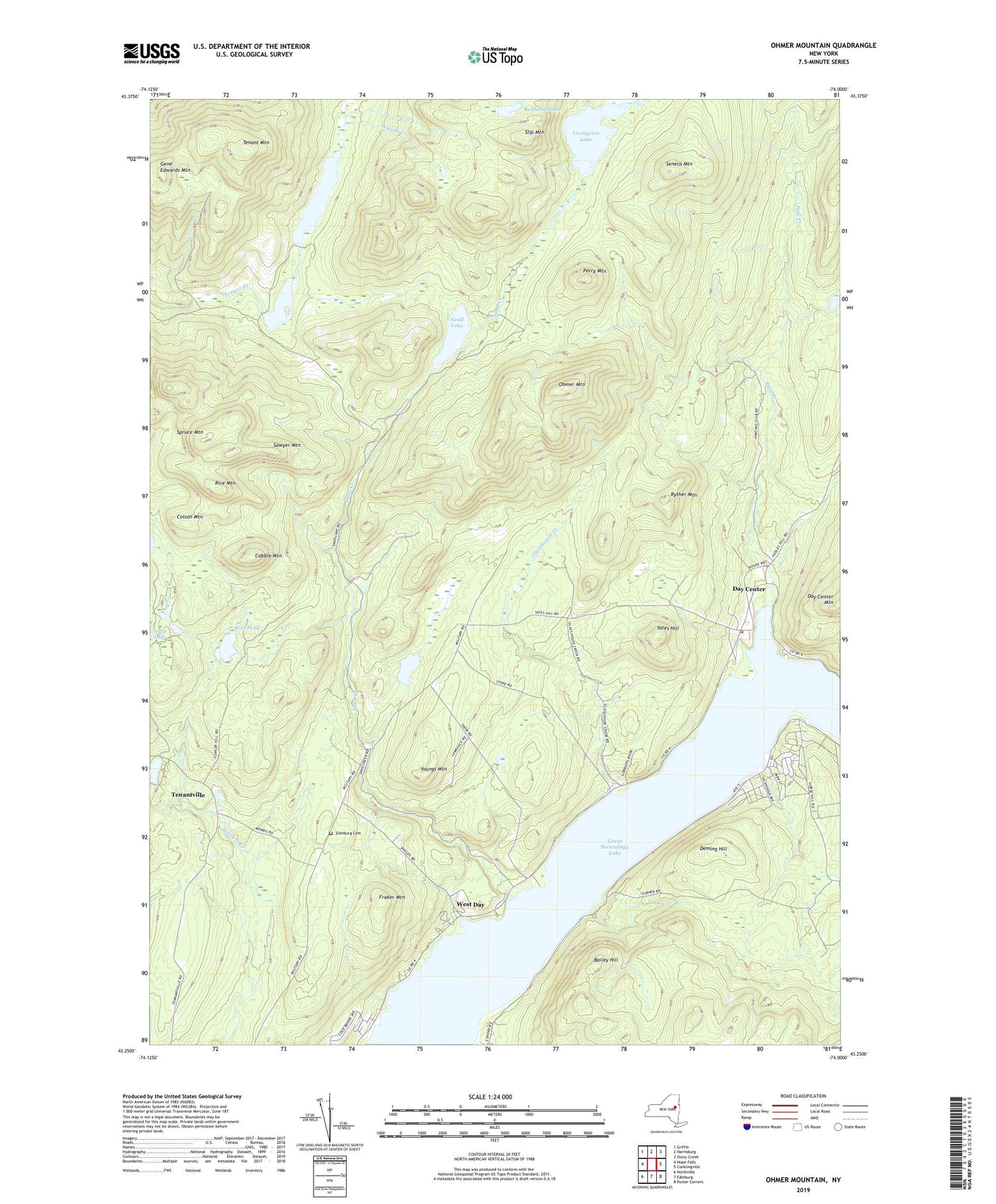
2019 topographic map quadrangle Ohmer Mountain in the state of New York. Scale: 1:24000. Based on the newly updated USGS 7.5' US Topo map series, this map is in the following counties: Saratoga, Warren. The map contains contour data, water features, and other items you are used to seeing on USGS maps, but also has updated roads and other features. This is the next generation of topographic maps. Printed on high-quality waterproof paper with UV fade-resistant inks.
Quads adjacent to this one:
West: Hope Falls
Northwest: Griffin
North: Harrisburg
Northeast: Stony Creek
East: Conklingville
Southeast: Porter Corners
South: Edinburg
Southwest: Northville
Contains the following named places: Bailey Hill, Bullhead Pond, Cobble Mountain, Colson Mountain, Day Center, Deming Hill, Edinburg Cemetery, Edinburg Church, Fraker Mountain, Glasshouse Creek, Lake View, Livingston Lake, Ohmer Mountain, Olmstead Camp, Paul Creek, Perry Mountain, Rice Mountain, Rice Pond, Rocky Mountain Camp, Ryther Mountain, Sand Creek, Sand Lake, Sawyer Mountain, Seneca Mountain, Slip Mountain, Spruce Mountain, Tenant Lake, Tenant Mountain, Tenantville, Town of Day, West Day, Yates Hill, Youngs Mountain, ZIP Code: 12835