MyTopo
Porter Corners New York US Topo Map
Couldn't load pickup availability
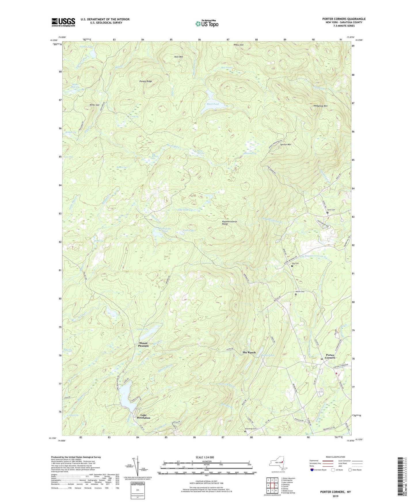
2023 topographic map quadrangle Porter Corners in the state of New York. Scale: 1:24000. Based on the newly updated USGS 7.5' US Topo map series, this map is in the following counties: Saratoga. The map contains contour data, water features, and other items you are used to seeing on USGS maps, but also has updated roads and other features. This is the next generation of topographic maps. Printed on high-quality waterproof paper with UV fade-resistant inks.
Quads adjacent to this one:
West: Edinburg
Northwest: Ohmer Mountain
North: Conklingville
Northeast: Lake Luzerne
East: Corinth
Southeast: Saratoga Springs
South: Middle Grove
Southwest: Galway
This map covers the same area as the classic USGS quad with code o43073b8.
Contains the following named places: Archer Vly, Ballou Cemetery, Balsam Brook, Bear Swamp, Big Brewer Vly, Black Pond, Brewer Vly, Brookhaven Golf Club, Bucket Pond, Burnt Mill Creek, Burnt Mill Vly, Cady Vly, Day Cemetery, Della Mobile Estates, Earls Cemetery, Graves Vly, Greenfield Fire District Porter Corners Fire Company 2, Hedgehog Mountain, Hutchings Cemetery, John West Vly, Johns Vly, Kayaderosseras Range, Lake Desolation, Little Lake, Macomber Vly, Miner Hill, Miner Mill Vly, Mount Pleasant, Mulleyville Pond, Negro Hill, Nick Mountain, Niffin Vly, Palmer Lake, Pompy Ridge, Porter Corners, Porter Corners Methodist Church, Porter Corners Post Office, Randall Creek, Sky Ranch, South Branch Kayaderosseras Creek, Spruce Mountain, Town of Corinth, Town of Greenfield, Vly Creek, ZIP Codes: 12822, 12859