MyTopo
Northville New York US Topo Map
Couldn't load pickup availability
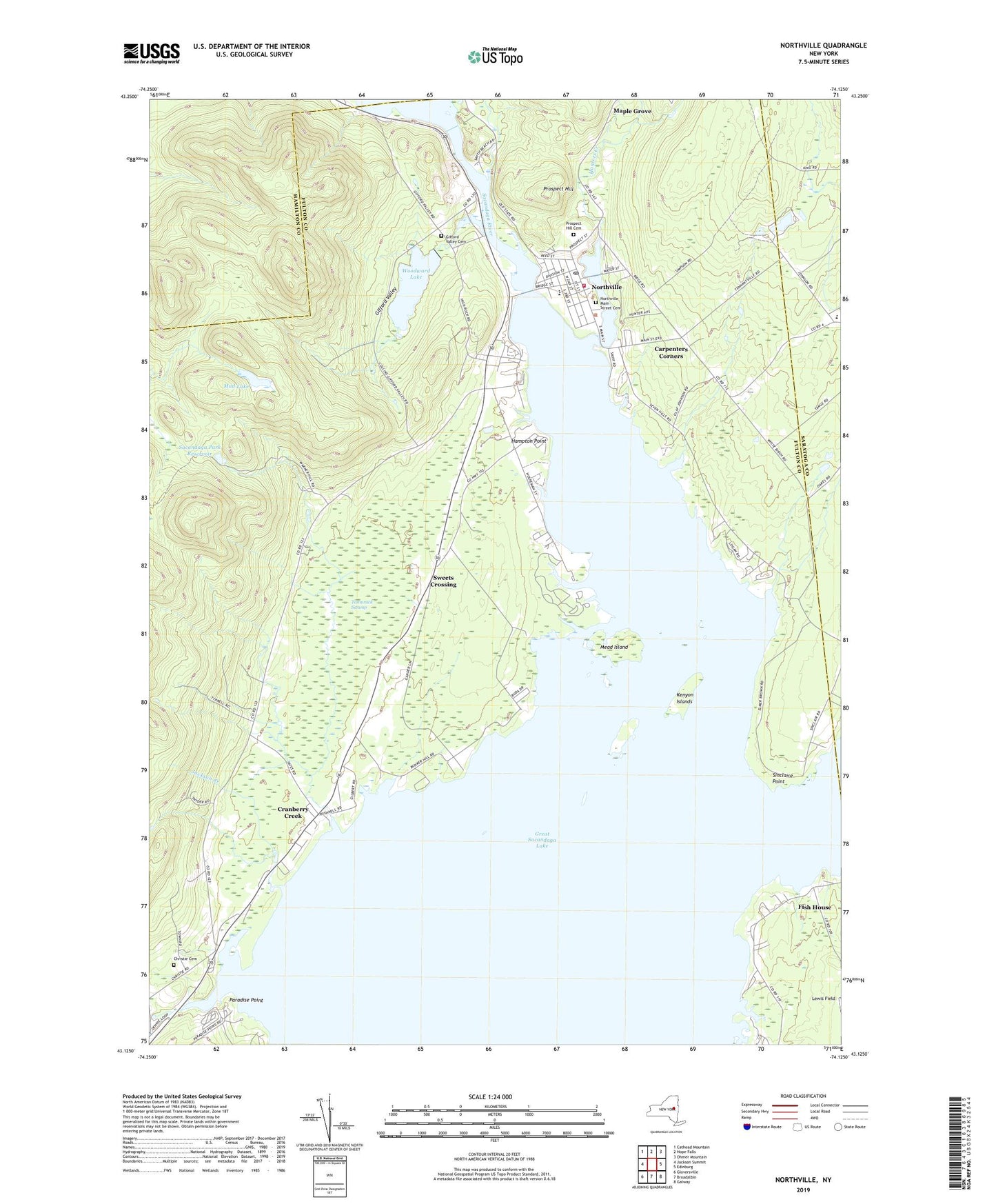
2023 topographic map quadrangle Northville in the state of New York. Scale: 1:24000. Based on the newly updated USGS 7.5' US Topo map series, this map is in the following counties: Fulton, Hamilton, Saratoga. The map contains contour data, water features, and other items you are used to seeing on USGS maps, but also has updated roads and other features. This is the next generation of topographic maps. Printed on high-quality waterproof paper with UV fade-resistant inks.
Quads adjacent to this one:
West: Jackson Summit
Northwest: Cathead Mountain
North: Hope Falls
Northeast: Ohmer Mountain
East: Edinburg
Southeast: Galway
South: Broadalbin
Southwest: Gloversville
This map covers the same area as the classic USGS quad with code o43074b2.
Contains the following named places: Baptist Church of Northville, Birch Haven Campground, Carpenters Corners, Christie Cemetery, Cranberry Creek, Edinburg Common School, Fairchilds Corners, First United Methodist Church of Northville, Fish House, Gifford Valley, Gifford Valley Cemetery, Great Sacandaga Lake, Hampton Point, Heyday Mobile Home Park, Hunters Creek, Jackson Creek, Kenyon Islands, Lake View Orchards, Lakeside Mobile Estates, Mead Island, Mud Lake, Northampton Ambulance Service, Northampton Beach Campsite, Northampton Town Hall, Northampton United Methodist Church, Northville, Northville Elementary School, Northville Fire Department, Northville High School, Northville Main Street Cemetery, Northville Post Office, Northville Presbyterian Church, Osbourne Bridge, Paradise Point, Prospect Hill, Prospect Hill Cemetery, Sacandaga Golf Club, Sacandaga Park, Sacandaga Park Reservoir, Saint Francis Church, Sinclaire Point, Sweets Crossing, Tamarack Swamp, Town of Northampton, Village of Northville, Woodward Lake