MyTopo
Otego New York US Topo Map
Couldn't load pickup availability
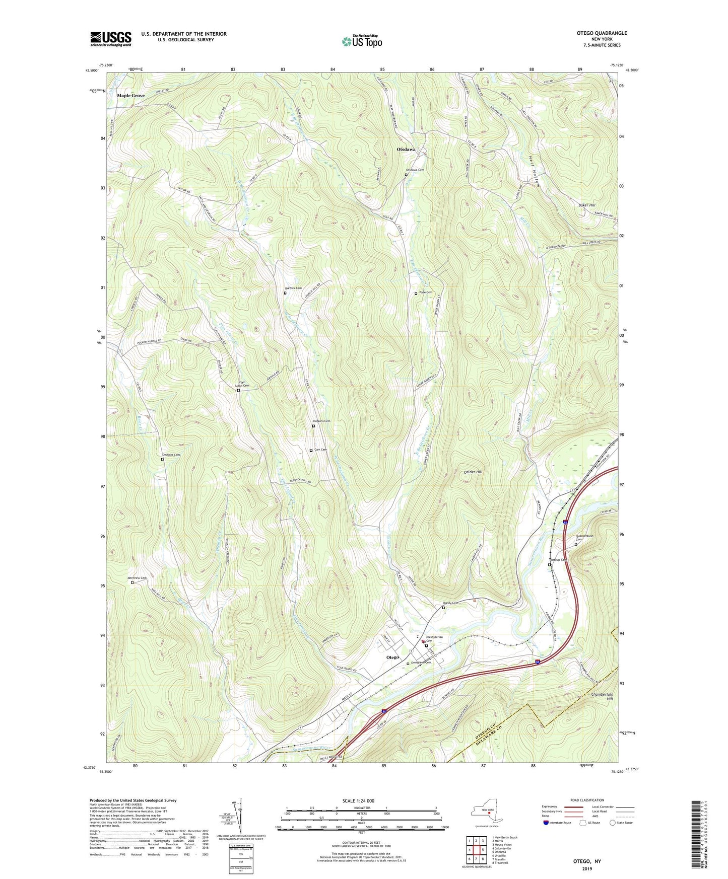
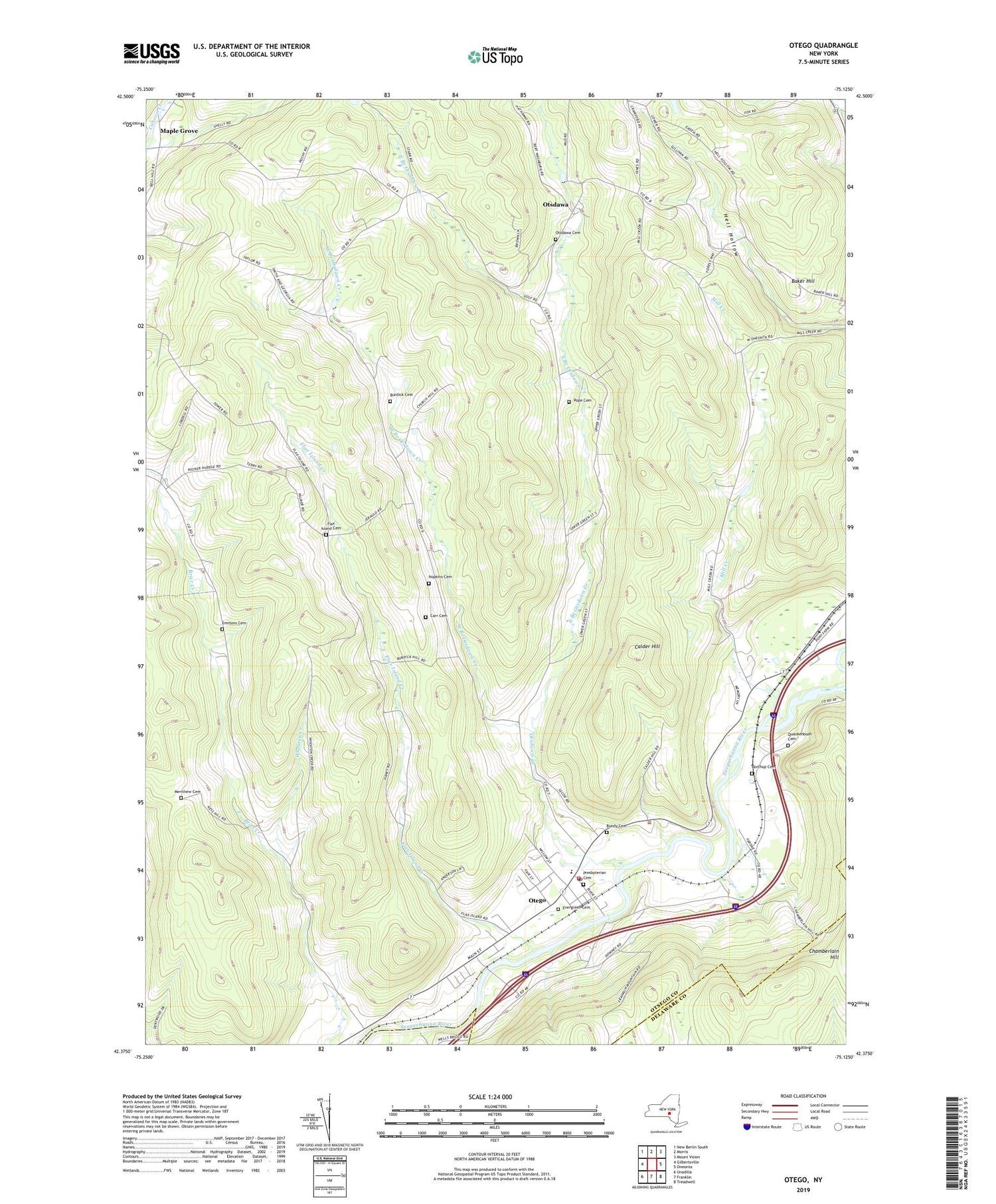
2019 topographic map quadrangle Otego in the state of New York. Scale: 1:24000. Based on the newly updated USGS 7.5' US Topo map series, this map is in the following counties: Otsego, Delaware. The map contains contour data, water features, and other items you are used to seeing on USGS maps, but also has updated roads and other features. This is the next generation of topographic maps. Printed on high-quality waterproof paper with UV fade-resistant inks.
Quads adjacent to this one:
West: Gilbertsville
Northwest: New Berlin South
North: Morris
Northeast: Mount Vision
East: Oneonta
Southeast: Treadwell
South: Franklin
Southwest: Unadilla
Contains the following named places: Baker Hill, Bundy Cemetery, Burdick Cemetery, Calder Hill, Carr Cemetery, Cook Corners, East Branch Otsdawa Creek, Emmons Cemetery, Evergreen Cemetery, First Christian Church, Flax Island Cemetery, Flax Island Creek, Harris Memorial Library, Hopkins Cemetery, Lundins Tree Farm, Maple Grove, Merithew Cemetery, Mill Creek, Mill Creek Estates, Northup Cemetery, Otego, Otego Baptist Church, Otego Church, Otego Elementary School, Otego Emergency Squad, Otego Post Office, Otego Presbyterian Church, Otego United Methodist Church, Otego Volunteer Fire Department, Otsdawa, Otsdawa Cemetery, Otsdawa Creek, Perry School, Pope Cemetery, Presbyterian Cemetery, Quackenbush Cemetery, School Number 4, Seefield Farm, Town of Otego, Village of Otego, West Branch Otsdawa Creek, Wheaton Creek, ZIP Code: 13825