MyTopo
Mount Vision New York US Topo Map
Couldn't load pickup availability
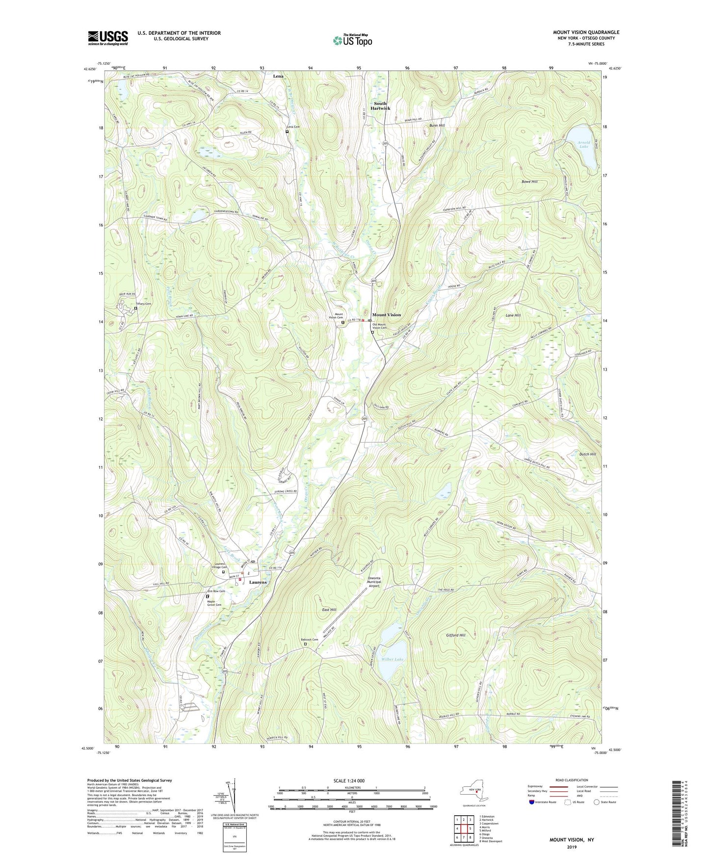
2023 topographic map quadrangle Mount Vision in the state of New York. Scale: 1:24000. Based on the newly updated USGS 7.5' US Topo map series, this map is in the following counties: Otsego. The map contains contour data, water features, and other items you are used to seeing on USGS maps, but also has updated roads and other features. This is the next generation of topographic maps. Printed on high-quality waterproof paper with UV fade-resistant inks.
Quads adjacent to this one:
West: Morris
Northwest: Edmeston
North: Hartwick
Northeast: Cooperstown
East: Milford
Southeast: West Davenport
South: Oneonta
Southwest: Otego
This map covers the same area as the classic USGS quad with code o42075e1.
Contains the following named places: Arnold Lake, Babcock Cemetery, Bowe Hill, Bunn Hill, East Hill, Elm Row Cemetery, Fall Bridge, Gifford Hill, Keyes Brook, Lake Brook, Lane Hill, Laurens, Laurens Central School, Laurens Post Office, Laurens Presbyterian Church, Laurens Village Cemetery, Laurens Volunteer Fire Department, Lena, Lena Cemetery, Maple Grove Cemetery, Meadow Vale Campsites, Mount Vision, Mount Vision Cemetery, Mount Vision Census Designated Place, Mount Vision Post Office, Mount Vision Volunteer Fire Department, Old Mount Vision Cemetery, Oneonta Municipal Airport, Pleasant Valley, Pool Brook, Saint Matthew Lutheran Church, School Number 10, School Number 11, School Number 13, School Number 14, School Number 3, School Number 5, School Number 9, South Hartwick, Tiffany Cemetery, Town of Laurens, Village of Laurens, West Branch Otego Creek, Wharton Creek, Wilber Lake, ZIP Code: 13810