MyTopo
Pleasant Valley New York US Topo Map
Couldn't load pickup availability
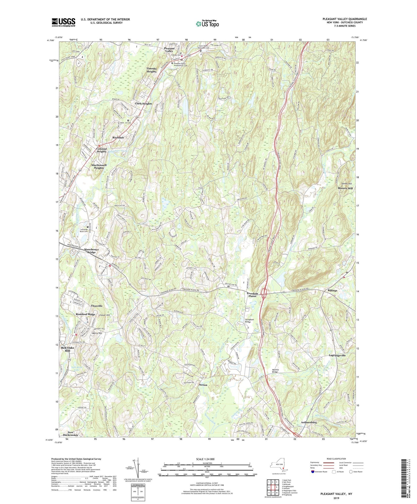
2019 topographic map quadrangle Pleasant Valley in the state of New York. Scale: 1:24000. Based on the newly updated USGS 7.5' US Topo map series, this map is in the following counties: Dutchess. The map contains contour data, water features, and other items you are used to seeing on USGS maps, but also has updated roads and other features. This is the next generation of topographic maps. Printed on high-quality waterproof paper with UV fade-resistant inks.
Quads adjacent to this one:
West: Poughkeepsie
Northwest: Hyde Park
North: Salt Point
Northeast: Millbrook
East: Verbank
Southeast: Poughquag
South: Hopewell Junction
Southwest: Wappingers Falls
Contains the following named places: All Saints Lutheran Church, Arthursburg, Beth - El Cemetery, Billings, Billings Post Office, Blessed Kateri Tekakwitha Catholic Church, Brendon Montessori School, Chabad Lubavitch Center, Clark Heights, Clover Hill, Colonial Heights, East Bend Lake, Elks Camp, Ennis Mobile Home Park, Feller Mobile Home Park, Freedom Plains, Freedom Plains Census Designated Place, Freedom Plains Presbyterian Church, Friends Cemetery, Full Gospel Center, Jackson Creek, James Baird State Park, James Baird State Park Golf Course, Kingdom Hall of Jehovahs Witnesses, La Grange Fire Company 2, La Grange Rural Cemetery, Lagrange Association Library, LaGrange Elementary School, LaGrange Middle School, Lagrangeville, Lagrangeville Post Office, Lutheran Center at Poughkeepsie Nursing Home, MacDonnell Heights, MacDonnell Heights Census Designated Place, Manchester Bridge, Merry Hill, Millett Tree Farm, Montfor Bridge, New Beginnings Christian and Missionary Alliance Church, Noxon, Noxon Road Elementary School, Overlook Drive-In, Overlook Primary School, Pleasant Valley, Pleasant Valley Census Designated Place, Pleasant Valley Fire Company 1, Pleasant Valley Free Library, Pleasant Valley Post Office, Pleasant Valley Presbyterian Cemetery, Pleasant Valley Presbyterian Church, Pleasant Valley United Methodist Church, Pond Gut, Red Oaks Mill, Red Oaks Mill Census Designated Place, Rochdale, Rochdale Fire Company, Rockhedge Herb Farm, Rombout Ridge, S W Phelps LaGrange Fire Company 1, Saint Andrew's Episcopal Church, Saint Paul's Episcopal Cemetery, Saint Pauls Episcopal Church, Saint Stanislaus Church, Shady Brook, Shady Brook Mobile Home Park, Southwest LaGrange Fire Company 3, Stringham Bridge, Sunset Hill, Taconic-Hereford State Multiple Use Area, Timothy Heights, Titusville, Titusville Census Designated Place, Titusville Intermediate School, Town of La Grange, Traver Road Primary School, Trinity United Methodist Church, West Road-D'Aquanni Intermediate School, WRNQ-FM (Poughkeepsie), ZIP Codes: 12569, 12603