MyTopo
Verbank New York US Topo Map
Couldn't load pickup availability
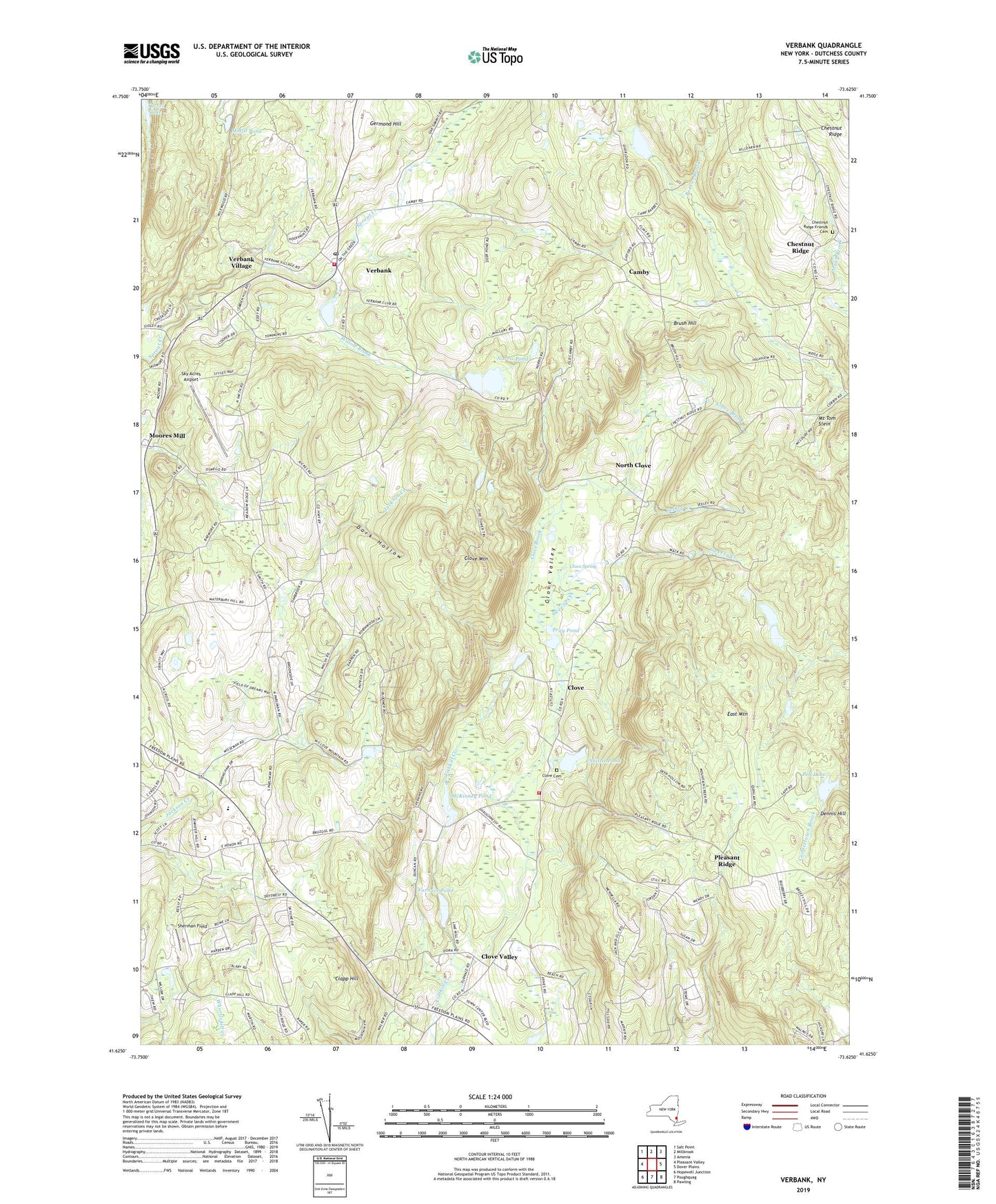
2023 topographic map quadrangle Verbank in the state of New York. Scale: 1:24000. Based on the newly updated USGS 7.5' US Topo map series, this map is in the following counties: Dutchess. The map contains contour data, water features, and other items you are used to seeing on USGS maps, but also has updated roads and other features. This is the next generation of topographic maps. Printed on high-quality waterproof paper with UV fade-resistant inks.
Quads adjacent to this one:
West: Pleasant Valley
Northwest: Salt Point
North: Millbrook
Northeast: Amenia
East: Dover Plains
Southeast: Pawling
South: Poughquag
Southwest: Hopewell Junction
This map covers the same area as the classic USGS quad with code o41073f6.
Contains the following named places: Beekman Library, Brush Hill, Camby, Camp Barbey, Chestnut Ridge, Chestnut Ridge Friends Cemetery, Christie Pond, Clapp Hill, Clove, Clove Brook, Clove Cemetery, Clove Hill Farm, Clove Mountain, Clove School, Clove Spring, Clove Valley, Clove Valley Alliance Church, Crazy Acres Farm, Crouses Store, Dark Hollow, Dennis Hill, East Mountain, Furnace Pond, Germond Hill, Godfrey Park, Greer School, Hope Farm, Hoxie Corner, John 316 Christian Center, Lakeside Grove Mobile Home Park, McKinney Pond, Metropolitan Camps, Moffit Pond, Moores Mill, Mount Tom Stein, Norris Pond, North Clove, Oswego Church, Pell Lake, Pleasant Ridge, Pray Pond, Seeley Creek, Sherman Field, Sky Acres Airport, Sprout Lake, Sweezy Creek, The Links at Union Vale, Town of Union Vale, Tymore Park, Union Vale Fire Company Station 2, Union Vale Fire Department, Union Vale Middle School, Union Vale Town Hall, Vail Farm Elementary School, Valley Bible Fellowship Church, Verbank, Verbank Methodist Church, Verbank Post Office, Verbank Village, Willow Brook, ZIP Codes: 12540, 12570, 12585