MyTopo
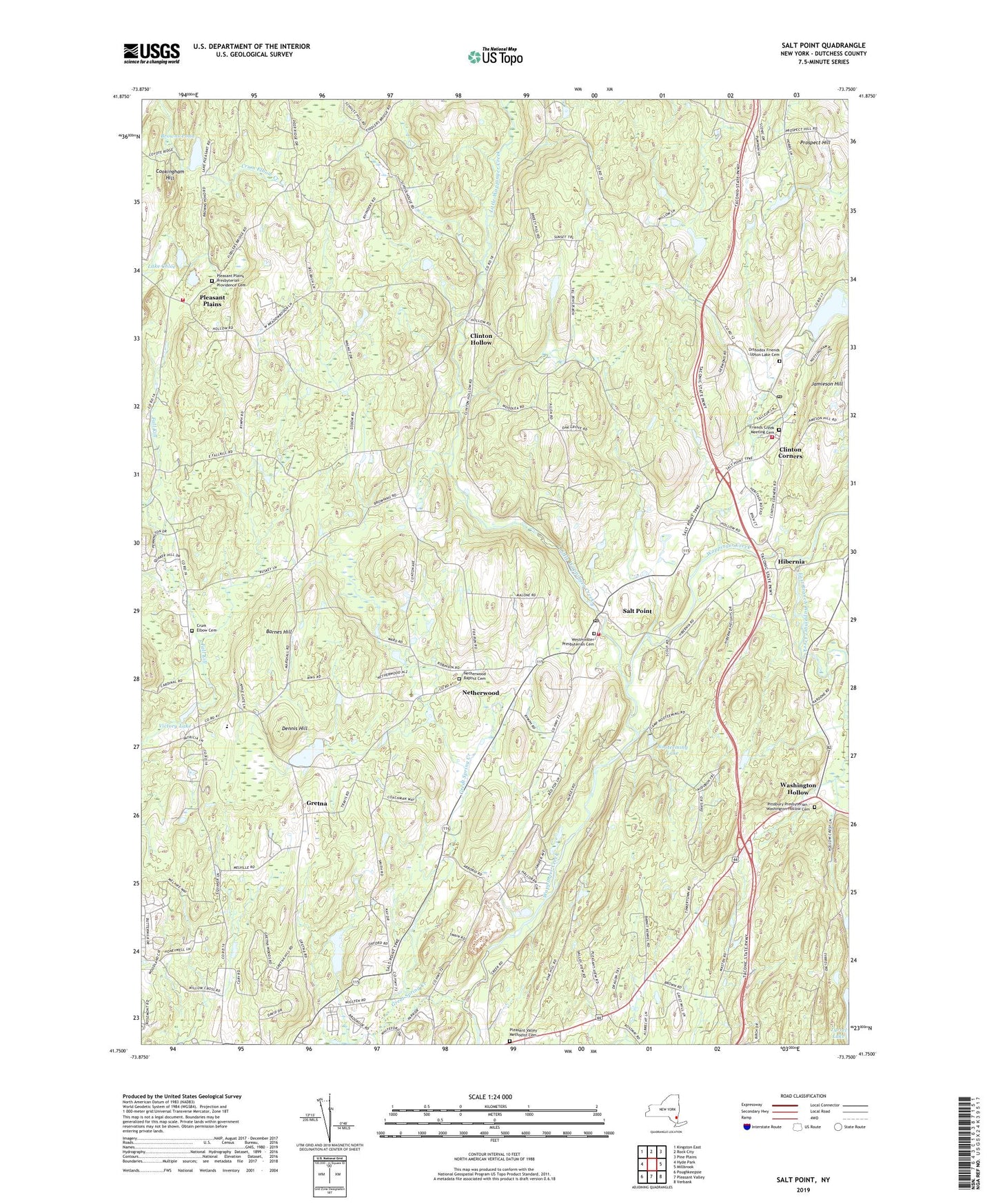
Salt Point New York US Topo Map
Couldn't load pickup availability
2023 topographic map quadrangle Salt Point in the state of New York. Scale: 1:24000. Based on the newly updated USGS 7.5' US Topo map series, this map is in the following counties: Dutchess. The map contains contour data, water features, and other items you are used to seeing on USGS maps, but also has updated roads and other features. This is the next generation of topographic maps. Printed on high-quality waterproof paper with UV fade-resistant inks.
Quads adjacent to this one:
West: Hyde Park
Northwest: Kingston East
North: Rock City
Northeast: Pine Plains
East: Millbrook
Southeast: Verbank
South: Pleasant Valley
Southwest: Poughkeepsie
This map covers the same area as the classic USGS quad with code o41073g7.
Contains the following named places: Barnes Hill, Birch Bark Acres, Black Sheep Farm, Bloomvale Historic District, Breezy Hill Orchard, Browns Pond, Camp Exton, Camp Nooteeming, Camp Victory, Campton School, Cedar Hollow Mobile Home Park, Central Baptist Church, Clinton Corners, Clinton Corners Post Office, Clinton Hollow, Clinton Vineyards, Cookingham Hill, Cornerstone Bible Fellowship Church, Crum Elbow Cemetery, Dennis Hill, Derry Dol Farm, East Branch Wappinger Creek, East Clinton Fire District, East Clinton Rescue Squad, Evangelical Free Church, Fall Kill School, Friends Creek Meeting Cemetery, Friends Park, Great Spring Creek, Gretna, Gretna School, Hahn Farm, Hibernia, Hickory Hills, His Way Ministries, Jamieson Hill, Jug Hill Camp, Lake Chloe, Little Wappinger Creek, Netherwood, Netherwood Baptist Cemetery, Netherwood Baptist Church, Netherwood School, Nooteeming Lake, Oak Grove School, Orthodox Friends - Upton Lake Cemetery, Pitssbury Presbyterian - Washington Hollow Cemetery, Pleasant Plains, Pleasant Plains Presbyterian - Providence Cemetery, Pleasant Plains Presbyterian Church, Pleasant Valley Methodist Cemetery, Primrose Hill Farm, Prospect Hill, Prospect Hill School, Quaker Lane Farms, Resurrection Bible Church, Ruskey School, Saint Josephs Church, Salt Point, Salt Point Census Designated Place, Salt Point Fire Department, Salt Point Post Office, Salt Point Recreation Park, School Number 2, School Number 8, State Police Troop K Heliport, Terhune Orchards, Tinkertown School, Town of Clinton, Town of Pleasant Valley, Upton Lake, Upton Lake Christian School, Valley Community Church, Victory Lake, Victory Lake Nursing Center, Washington Hollow, West Clinton Fire Department Station 1, Westminster Presbyterian Cemetery, Westminster Presbyterian Church, Wigstens Farm, ZIP Codes: 12578, 12580