MyTopo
Putnam New York US Topo Map
Couldn't load pickup availability
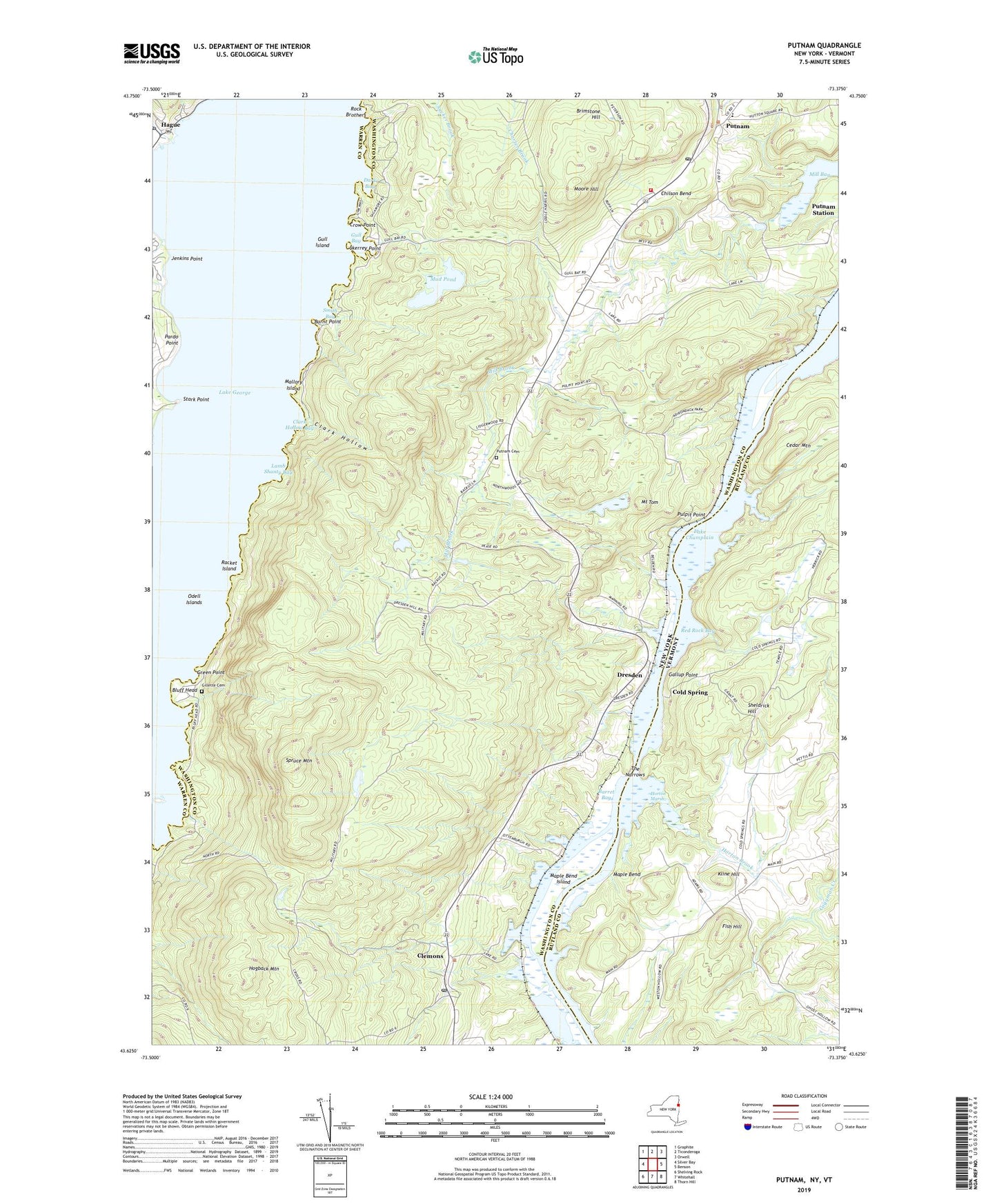
2019 topographic map quadrangle Putnam in the states of New York, Vermont. Scale: 1:24000. Based on the newly updated USGS 7.5' US Topo map series, this map is in the following counties: Washington, Rutland, Warren. The map contains contour data, water features, and other items you are used to seeing on USGS maps, but also has updated roads and other features. This is the next generation of topographic maps. Printed on high-quality waterproof paper with UV fade-resistant inks.
Quads adjacent to this one:
West: Silver Bay
Northwest: Graphite
North: Ticonderoga
Northeast: Orwell
East: Benson
Southeast: Thorn Hill
South: Whitehall
Southwest: Shelving Rock
Contains the following named places: Agnes Island, Arcady Country Club, Barret Bay, Bluff Head, Brimstone Hill, Burnt Point, Camp Endion, Camp Mohican, Camp Sagamore, Cedar Mountain, Chilson Bend, Chubbs Dock, Chubbs Dock Light, Clark Hollow, Clark Hollow Bay, Clemons, Clemons Post Office, Cold Spring, Crow Point, Dark Bay, Dresden, Dresden Center, Dresden Station Post Office, Fish Hill, Gallup Point, Gillette Cemetery, Green Point, Gull Bay, Gull Island, Hague, Hague Brook, Hague Post Office, Hogback Mountain, Horton Brook, Horton Marsh, Jabe Pond Brook, Jenkins Point, Kline Hill, Lamb Shanty Bay, Mallory Island, Maple Bend, Maple Bend Island, Mill Bay, Mill Brook, Moore Hill, Mount Tom, Mud Pond, Odell Islands, Old Maid Place Lighthouse, Ottenburgs Ramp, Pardo Point, Pudding Island, Pulpit Point, Putnam, Putnam Cemetery, Putnam Central School, Putnam Church, Putnam Station Post Office, Putnam Volunteer Fire Company, Racket Island, Red Rock Bay, Rock Brothers, Scotch Bonnet Island, Sheldrick Hill, Skerrey Point, Skipper Island, Smith Bay, Spruce Mountain, Stark Point, Swale School, The Narrows, ZIP Code: 12861