MyTopo
Benson Vermont US Topo Map
Couldn't load pickup availability
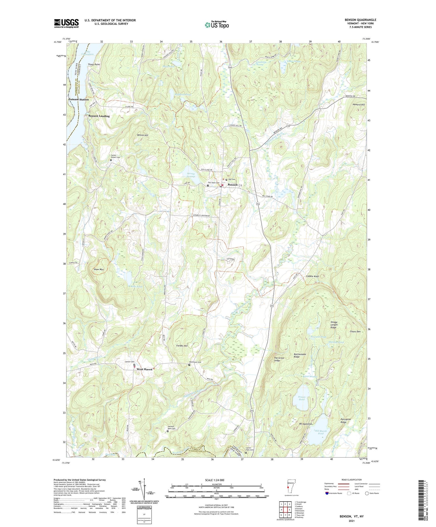
2024 topographic map quadrangle Benson in the states of Vermont, New York. Scale: 1:24000. Based on the newly updated USGS 7.5' US Topo map series, this map is in the following counties: Rutland, Washington. The map contains contour data, water features, and other items you are used to seeing on USGS maps, but also has updated roads and other features. This is the next generation of topographic maps. Printed on high-quality waterproof paper with UV fade-resistant inks.
Quads adjacent to this one:
West: Putnam
Northwest: Ticonderoga
North: Orwell
Northeast: Sudbury
East: Bomoseen
Southeast: Poultney
South: Thorn Hill
Southwest: Whitehall
This map covers the same area as the classic USGS quad with code o43073f3.
Contains the following named places: Aiken School, Beaver Meadow, Benson, Benson Census Designated Place, Benson Fire Department, Benson First Response, Benson Landing, Benson Post Office, Benson Town Hall, Benson Village Historic District, Benson Village School, Bullhead Pond, Bump School, Carter Street Cemetery, Carver Falls Cemetery, Carver Falls Dam, Center Cemetery, Center School, Claycreek Farm, Cobble Knoll, Coggman Creek, Coons Den, Cranberry Swamp, Fair Haven Municipal Forest, Fair View Cemetery, Forbes Hill, Hackett Dam Cemetery, Hitchcock Cemetery, Howard Dam, Howard Hill, Howard Hill School, Howard Pond, Hubbardton River, Inman Pond, Inman Pond Dam, Mill Pond, Mount Hamilton, Mud Pond, Old Cemetery, Old Marsh Pond, Old Marsh Pond Dam, Parsons Mill Dam, Pond Woods Wildlife Management Area, Porcupine Ridge, Poultney River, Putnam Station, Rattlesnake Ridge, Root Pond, Shaw Mountain, Sheldon Dam, Sheldon Pond, Sledge Length Ridge, Stony Point, Stony Point School, Strong Swamp, Sucker Creek, The Great Ledge, Town of Benson, Town of West Haven, Turnpike School, Walker Swamp, West Haven, West Haven Volunteer Fire Department, Wilcox Hill, ZIP Code: 05743