MyTopo
Silver Bay New York US Topo Map
Couldn't load pickup availability
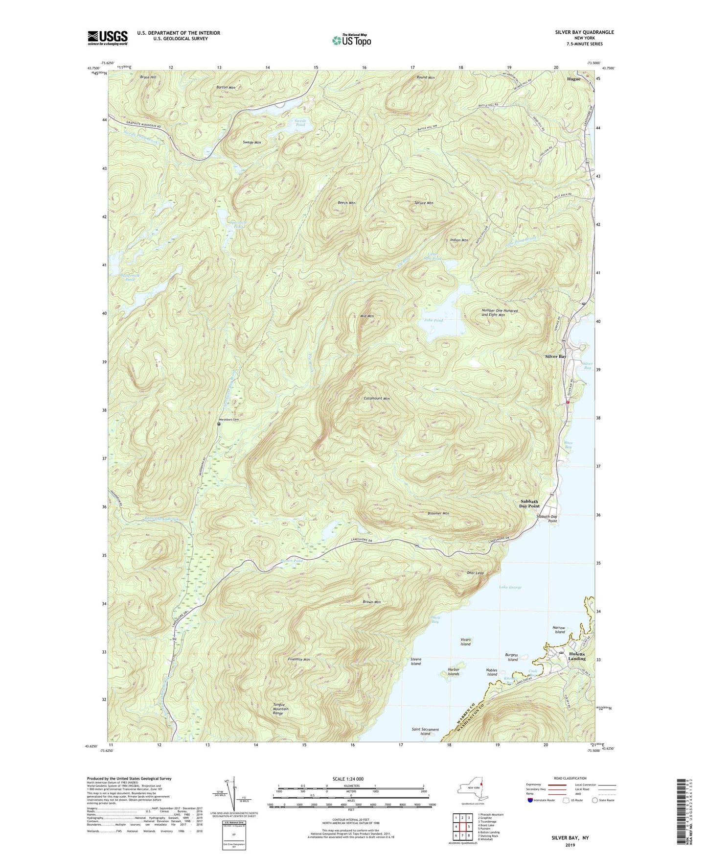
2023 topographic map quadrangle Silver Bay in the state of New York. Scale: 1:24000. Based on the newly updated USGS 7.5' US Topo map series, this map is in the following counties: Warren, Washington. The map contains contour data, water features, and other items you are used to seeing on USGS maps, but also has updated roads and other features. This is the next generation of topographic maps. Printed on high-quality waterproof paper with UV fade-resistant inks.
Quads adjacent to this one:
West: Brant Lake
Northwest: Pharaoh Mountain
North: Graphite
Northeast: Ticonderoga
East: Putnam
Southeast: Whitehall
South: Shelving Rock
Southwest: Bolton Landing
This map covers the same area as the classic USGS quad with code o43073f5.
Contains the following named places: Barton Mountain, Bass Bay, Beech Mountain, Bloomer Mountain, Brace Hill, Brown Mountain, Brown Pond, Burgess Island, Buttermilk Pond, Catamount Mountain, Cook Bay, Davis Bay, Deer Leap, Fivemile Mountain, Fly Brook, Hague Volunteer Fire Department and Emergency Squad Station 2, Hague Wesleyan Church, Harbor Islands, Hauge Baptist Church, Hulett's Golf Course, Huletts Island, Huletts Landing, Huletts Landing Post Office, Indian Mountain, Jabe Pond, Kitchal Bay, Little Jabe Pond, Loon Island, Meadow Point, Middle Mountain, Narrow Island, Nobles Island, North Pond, Number One Hundred and Eight Mountain, Rock Dunder Island, Round Mountain, Round Pond Brook, Sabbath Day Point, Sabbath-Day Point, Saint Sacrament Island, Silver Bay, Silver Bay Post Office, Slim Point, Spectacle Pond, Spruce Mountain, Steere Island, Swede Mountain, Swede Pond, Tongue Mountain Range, Town of Hague, Union Chapel, Van Buren Bay, Vicars Island, Wardsboro Cemetery, Wolf Pond, ZIP Codes: 12836, 12874