
MyTopo
Redfield New York US Topo Map
Couldn't load pickup availability
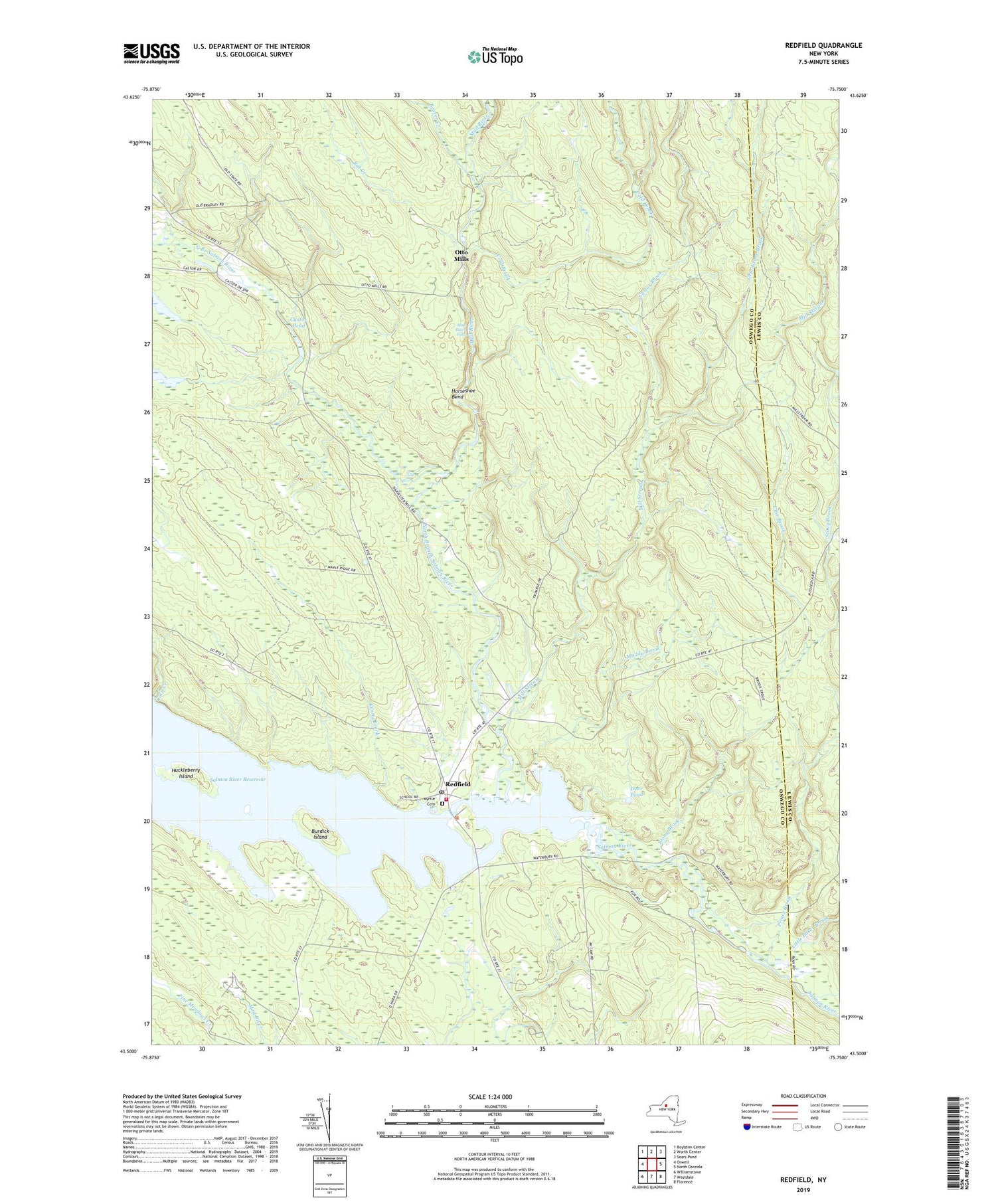
2019 topographic map quadrangle Redfield in the state of New York. Scale: 1:24000. Based on the newly updated USGS 7.5' US Topo map series, this map is in the following counties: Oswego, Lewis. The map contains contour data, water features, and other items you are used to seeing on USGS maps, but also has updated roads and other features. This is the next generation of topographic maps. Printed on high-quality waterproof paper with UV fade-resistant inks.
Quads adjacent to this one:
West: Orwell
Northwest: Boylston Center
North: Worth Center
Northeast: Sears Pond
East: North Osceola
Southeast: Florence
South: Westdale
Southwest: Williamstown
Contains the following named places: Beaver Creek, Burdick Island, Castor Brook, Castor Pond, Coey Creek, Cold Brook, Deer Pond, Fox Brook, Grindstone Brook, Horseshoe Bend, Huckleberry Island, Kenny Brook, Line Brook, Little Baker Brook, Mad River, Mad River Falls, Mill Stream, Muddy Brook, Myrtle Cemetery, North Branch Salmon River, Otto Mills, Prince Brook, Rat Creek, Redfield, Redfield Post Office, Redfield Volunteer Fire Department, Salmon River, School Number 1, School Number 5, School Number 9, Stony Brook, Town of Redfield, ZIP Code: 13437


