MyTopo
Sears Pond New York US Topo Map
Couldn't load pickup availability
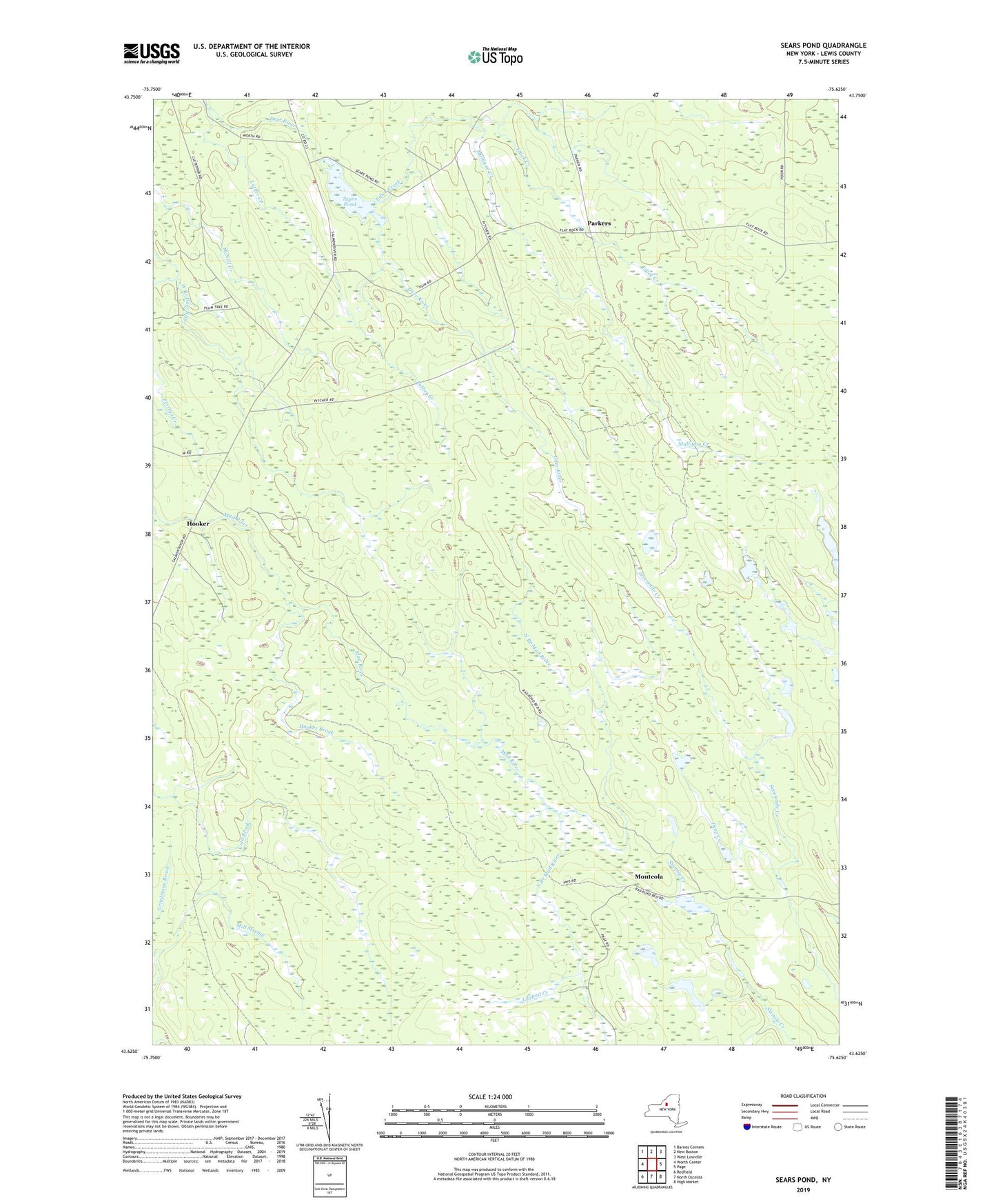
2023 topographic map quadrangle Sears Pond in the state of New York. Scale: 1:24000. Based on the newly updated USGS 7.5' US Topo map series, this map is in the following counties: Lewis. The map contains contour data, water features, and other items you are used to seeing on USGS maps, but also has updated roads and other features. This is the next generation of topographic maps. Printed on high-quality waterproof paper with UV fade-resistant inks.
Quads adjacent to this one:
West: Worth Center
Northwest: Barnes Corners
North: New Boston
Northeast: West Lowville
East: Page
Southeast: High Market
South: North Osceola
Southwest: Redfield
This map covers the same area as the classic USGS quad with code o43075f6.
Contains the following named places: Deep Creek, Edick Creek, Hooker, Hooker Brook, Lilypad Creek, Luther Creek, Monteola, Mulligan Creek, North Branch Mad River, Parkers, School Number 3, School Number 7, School Number 9, Sears Pond, South Branch Mad River, Town of Montague