MyTopo
Stony Creek New York US Topo Map
Couldn't load pickup availability
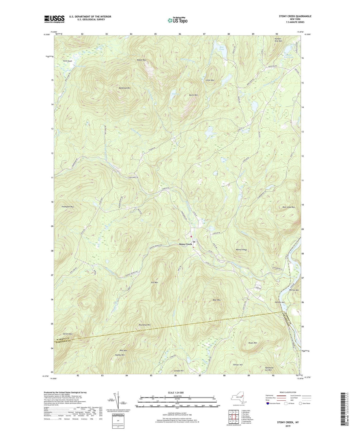
2019 topographic map quadrangle Stony Creek in the state of New York. Scale: 1:24000. Based on the newly updated USGS 7.5' US Topo map series, this map is in the following counties: Warren, Saratoga. The map contains contour data, water features, and other items you are used to seeing on USGS maps, but also has updated roads and other features. This is the next generation of topographic maps. Printed on high-quality waterproof paper with UV fade-resistant inks.
Quads adjacent to this one:
West: Harrisburg
Northwest: Bakers Mills
North: Johnsburg
Northeast: The Glen
East: Warrensburg
Southeast: Lake Luzerne
South: Conklingville
Southwest: Ohmer Mountain
Contains the following named places: Baldhead Mountain, Bear Mountain, Bear Pond, Bryan Mountain, Burnt Mountain, Buttermilk Brook, Canada Hill, Cave Knoll, Deer Leap Mountain, Fodder Brook, Garner Hill, Gill Mountain, Hadley Mountain, High Street, Holmes Hill, Kenyontown Creek, Kidder Brook, Little Mountain, Moose Mountain, Number Nine Pond, Roaring Branch, Roundtop Mountain, Spruce Mountain, Stony Creek, Stony Creek Family Campground, Stony Creek Fire Station, Stony Creek Free Library, Stony Creek Post Office, Stony Creek Station, Twin Brooks, Vanauken Brook, Walnut Ridge, Welch Vly, West Mountain, Wills Creek, Wolf Pond, ZIP Code: 12810