MyTopo
The Glen New York US Topo Map
Couldn't load pickup availability
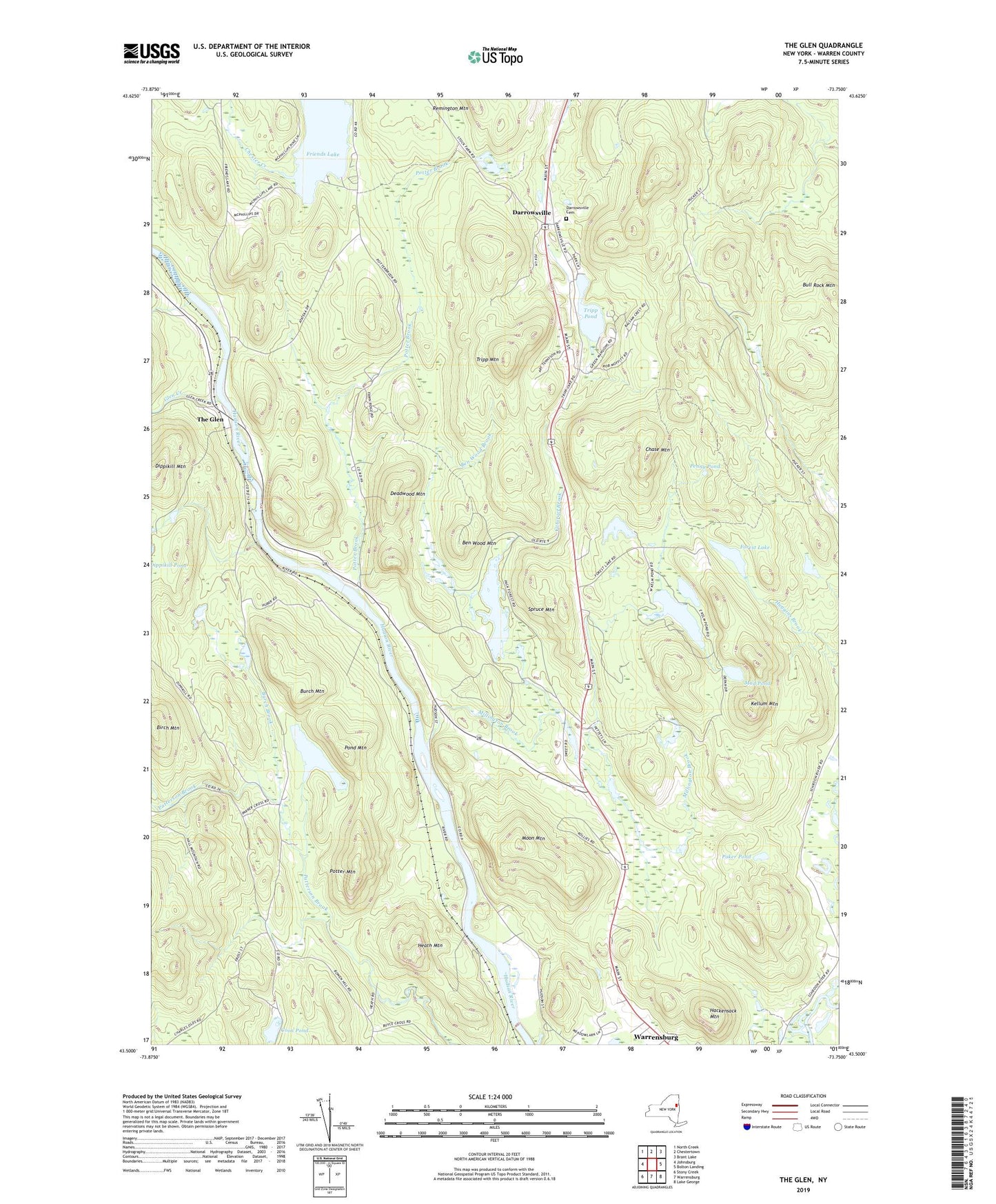
2023 topographic map quadrangle The Glen in the state of New York. Scale: 1:24000. Based on the newly updated USGS 7.5' US Topo map series, this map is in the following counties: Warren. The map contains contour data, water features, and other items you are used to seeing on USGS maps, but also has updated roads and other features. This is the next generation of topographic maps. Printed on high-quality waterproof paper with UV fade-resistant inks.
Quads adjacent to this one:
West: Johnsburg
Northwest: North Creek
North: Chestertown
Northeast: Brant Lake
East: Bolton Landing
Southeast: Lake George
South: Warrensburg
Southwest: Stony Creek
This map covers the same area as the classic USGS quad with code o43073e7.
Contains the following named places: Assembly of God Church, Ben Wood Brook, Ben Wood Mountain, Birch Mountain, Bull Rock Mountain, Burch Brook, Burch Mountain, Cataract Brook, Chase Mountain, Coon Pond, Countryside Adult Home, Cronins Golf Resort, Daggett Pond, Darrowsville, Darrowsville Cemetery, Deadwood Mountain, Dippikill Mountain, Forest Lake, Glen Creek, Green Mansions Golf Club, Hackensack Mountain, Heath Mountain, Kellum Mountain, Kellum Pond, Lake George Escape Camping Resort, Millington Brook, Moon Mountain, Mud Pond, Pack Demonstration Forest, Pack Forest Lake, Penny Pond, Poker Pond, Pond Mountain, Potter Brook, Potter Mountain, Remington Mountain, Schroon River Campsites, Spruce Mountain, The Glen, Town of Warrensburg, Tripp Mountain, Tripp Pond, Truthville Baptist Church, Warren County, Warrensburg Census Designated Place, ZIP Code: 12885