MyTopo
Truxton New York US Topo Map
Couldn't load pickup availability
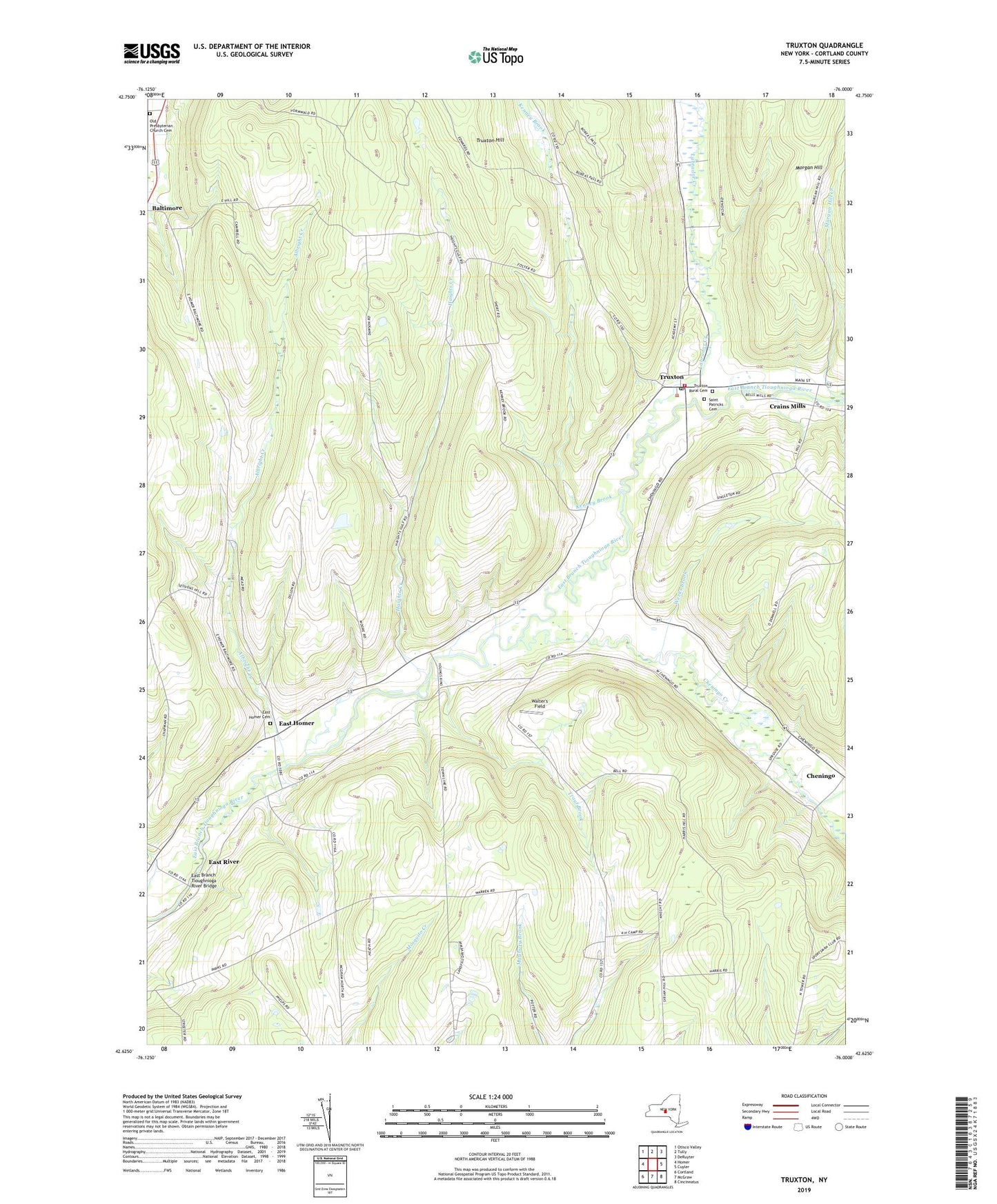
2019 topographic map quadrangle Truxton in the state of New York. Scale: 1:24000. Based on the newly updated USGS 7.5' US Topo map series, this map is in the following counties: Cortland. The map contains contour data, water features, and other items you are used to seeing on USGS maps, but also has updated roads and other features. This is the next generation of topographic maps. Printed on high-quality waterproof paper with UV fade-resistant inks.
Quads adjacent to this one:
West: Homer
Northwest: Otisco Valley
North: Tully
Northeast: DeRuyter
East: Cuyler
Southeast: Cincinnatus
South: McGraw
Southwest: Cortland
Contains the following named places: Albright Creek, Cheningo Creek, Cortland County Landfill, Crains Mills, East Branch Tioughnioga River Bridge, East Homer, East Homer Cemetery, East Homer School, East River, East River School, Haights Creek, Hartnett Elementary School, Heritage Farms, Hilltop Divine Dairy, Kenney Brook, Labrador Creek, Log School, Morgan Hill Creek, Old Presbyterian Church Cemetery, Pelham School, Saint Patricks Cemetery, Saint Patricks Church, School Number 3, School Number 5, School Number 8, Shuler School, South America School, Spring Valley Dairy Farm, Spruce Eden Farms, Town of Truxton, Trout Brook, Truxton, Truxton Fire Department, Truxton Methodist Church, Truxton Post Office, Truxton Rural Cemetery, Walter's Field, Weeks Brook