MyTopo
Tully New York US Topo Map
Couldn't load pickup availability
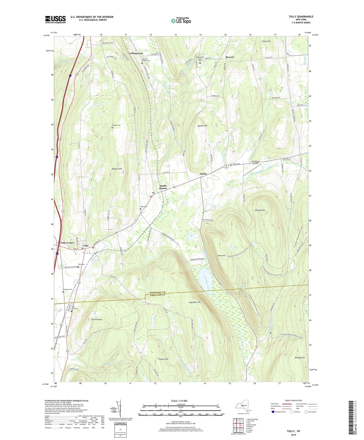
2023 topographic map quadrangle Tully in the state of New York. Scale: 1:24000. Based on the newly updated USGS 7.5' US Topo map series, this map is in the following counties: Onondaga, Cortland. The map contains contour data, water features, and other items you are used to seeing on USGS maps, but also has updated roads and other features. This is the next generation of topographic maps. Printed on high-quality waterproof paper with UV fade-resistant inks.
Quads adjacent to this one:
West: Otisco Valley
Northwest: South Onondaga
North: Jamesville
Northeast: Oran
East: DeRuyter
Southeast: Cuyler
South: Truxton
Southwest: Homer
This map covers the same area as the classic USGS quad with code o42076g1.
Contains the following named places: Apulia, Apulia Cemetery, Apulia Fire Department, Apulia Station, Apulia Station Post Office, Apulia United Methodist Church, Berwyn, Cascades Creek, Chase Hill, Clark Hollow, Collingwood, Cummings Crossing, Fellows Hill, Hill - N - Dale Country Club, Jerome Corners, Jones Hill, Labrador Hill, Labrador Pond, Maplewood Rural Cemetery, Markham Hollow, Matson Hill, Meeker Cemetery, Meeker Hill, Miles Cemetery, Old Tully Cemetery, Palladino Pit, Saint Leo's Catholic Church, Saint Leo's Cemetery, School Number 12, School Number 17, School Number 2, School Number 4, Shackham Brook, Sherman Hollow Cemetery, State Reforestation Area, Stump Pond, Swift Corner, The Cascades, The Pinnacle, Thermal Ridge Gliderport, Tinker Falls, Truxton Hill, Tully, Tully Cemetery, Tully Center, Tully Elementary School, Tully Fire Department, Tully Forest, Tully Free Library, Tully Junior - Senior High School, Tully Mobile Home Park, Tully Post Office, Tully United Community Church, Village of Tully, Woodford Airfield, ZIP Codes: 13020, 13159