MyTopo
DeRuyter New York US Topo Map
Couldn't load pickup availability
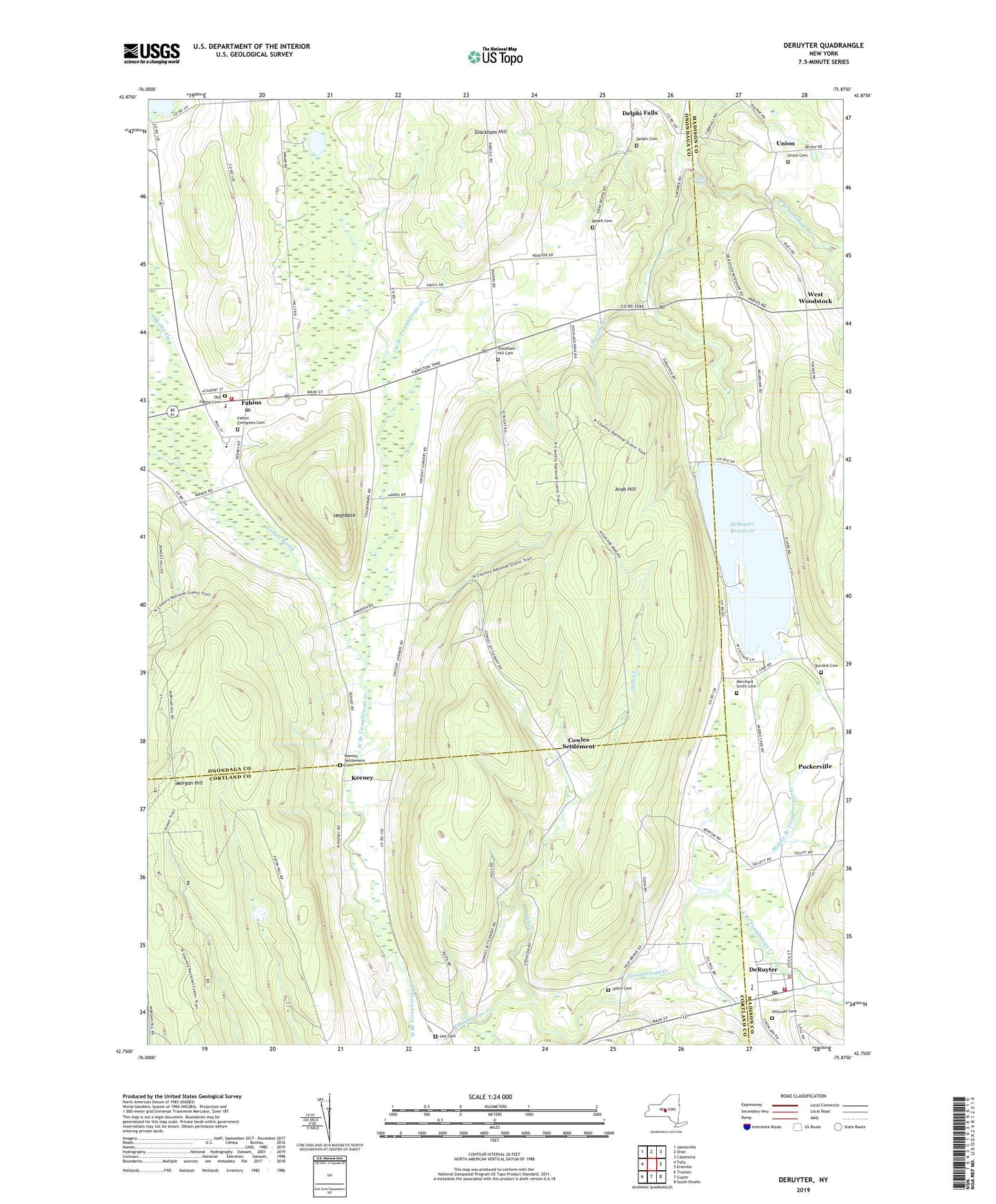
2023 topographic map quadrangle DeRuyter in the state of New York. Scale: 1:24000. Based on the newly updated USGS 7.5' US Topo map series, this map is in the following counties: Onondaga, Cortland, Madison. The map contains contour data, water features, and other items you are used to seeing on USGS maps, but also has updated roads and other features. This is the next generation of topographic maps. Printed on high-quality waterproof paper with UV fade-resistant inks.
Quads adjacent to this one:
West: Tully
Northwest: Jamesville
North: Oran
Northeast: Cazenovia
East: Erieville
Southeast: South Otselic
South: Cuyler
Southwest: Truxton
This map covers the same area as the classic USGS quad with code o42075g8.
Contains the following named places: Albro Cemetery, Arab Hill, Barbland Farms, Beach Cemetery, Burdick Cemetery, Carpenter Creek, Carpenter Pond, Cowles Settlement, De Ruyter Post Office, De Ruyter Town Hall, Delphi Cemetery, Delphi Falls, DeRuyter, DeRuyter Reservoir, East Branch Limestone Creek, East Branch Tioughnioga Creek, Fabius, Fabius - Pompey Elementary School, Fabius - Pompey Middle - High School, Fabius Baptist Church, Fabius Brook, Fabius Evergreen Cemetery, Fabius Fire Department, Fabius Post Office, Gooseville Corners, Hillcrest Cemetery, Hills Creek, Hogsback, Keeney, Keeney Settlement Cemetery, Lee Cemetery, Merchant Smith Cemetery, Middle Branch Tioughnioga Creek, Morgan Hill, Old Fabius Cemetery, Puckerville, Saint Lawrence Church, School Number 1, School Number 11, School Number 15, School Number 3, School Number 5, School Number 7, School Number 8, Smith Ambulance Service, Stockham Hill, Stockham Hill Cemetery, The Gulf, The Old Fly, Three Sisters Farm, Town of Fabius, Union, Union Cemetery, United Church of DeRuyter, Village of DeRuyter, Village of Fabius, Vincent Corners, West Woodstock, ZIP Code: 13063