MyTopo
Walton East New York US Topo Map
Couldn't load pickup availability
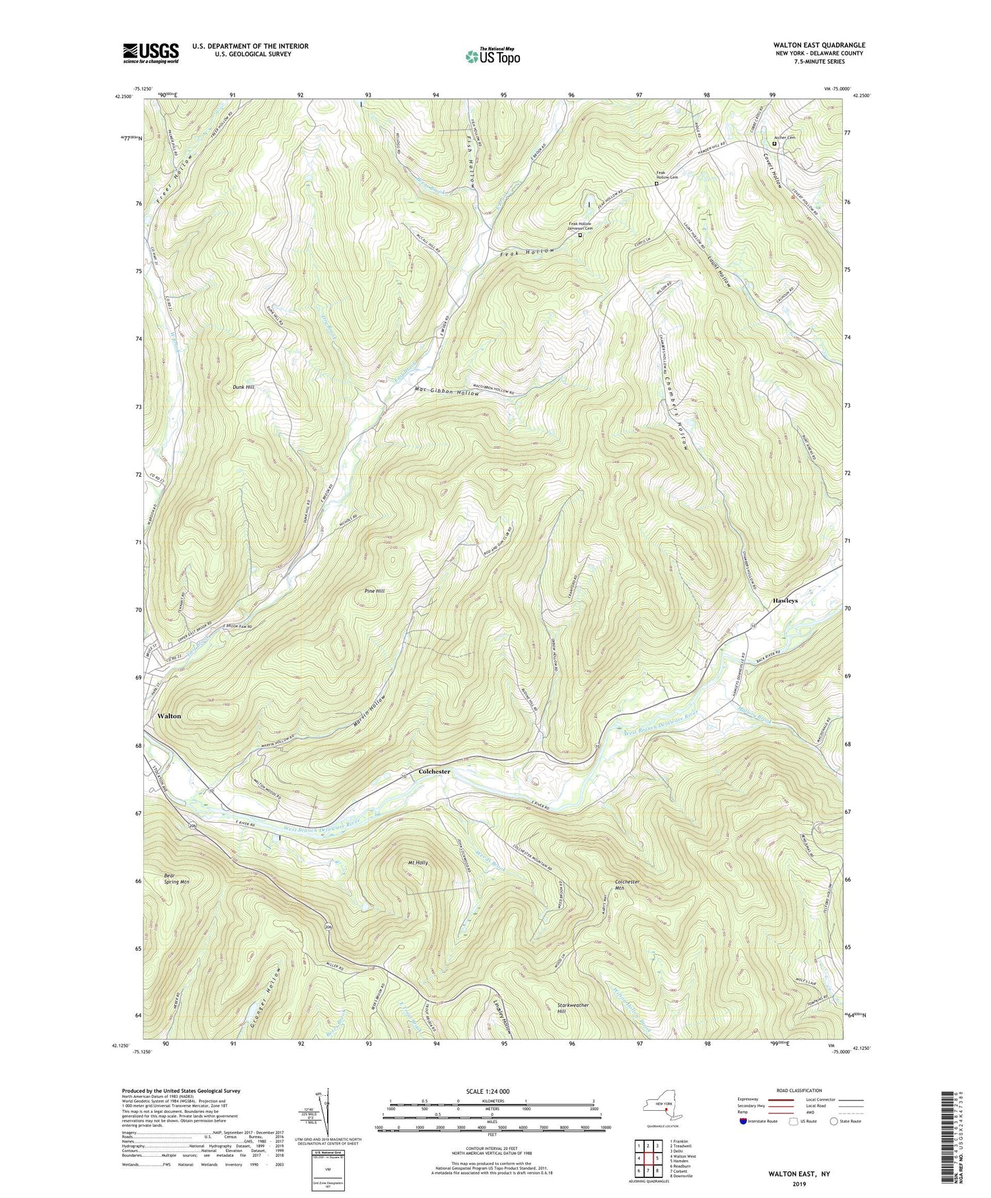
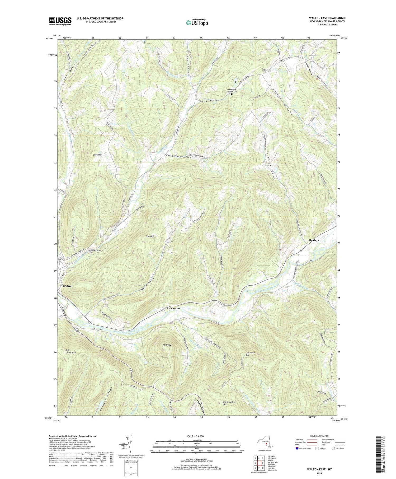
2019 topographic map quadrangle Walton East in the state of New York. Scale: 1:24000. Based on the newly updated USGS 7.5' US Topo map series, this map is in the following counties: Delaware. The map contains contour data, water features, and other items you are used to seeing on USGS maps, but also has updated roads and other features. This is the next generation of topographic maps. Printed on high-quality waterproof paper with UV fade-resistant inks.
Quads adjacent to this one:
West: Walton West
Northwest: Franklin
North: Treadwell
Northeast: Delhi
East: Hamden
Southeast: Downsville
South: Corbett
Southwest: Readburn
Contains the following named places: Archer Cemetery, Bassett Park, Bear Spring Mountain, Beers Brook, Chambers Hollow, Colchester, Colchester Mountain, Dry Brook, Dunk Hill, Dunk Hill Farm, Eagle Hollow Farm, Feak Hollow, Feak Hollow Cemetery, Feak Hollow Jamieson Cemetery, Fish Hollow, Hawleys, Kerrs Creek, Kingdom Hall of Jehovahs Witnesses, Lovey Day Farm, Mac Gibbon Hollow, Mallory Brook, Marvin Hollow, Mount Holly, New Hope Community Church, Oxbow Hollow, Pine Hill, Rocking L Ranch, Starkweather Hill, Walton Assembly of God, WDLA-AM (Walton), WDLA-FM (Walton), Weeds Brook