MyTopo
Downsville New York US Topo Map
Couldn't load pickup availability
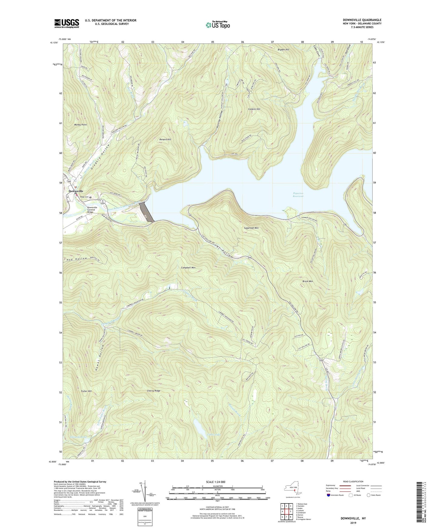
2023 topographic map quadrangle Downsville in the state of New York. Scale: 1:24000. Based on the newly updated USGS 7.5' US Topo map series, this map is in the following counties: Delaware. The map contains contour data, water features, and other items you are used to seeing on USGS maps, but also has updated roads and other features. This is the next generation of topographic maps. Printed on high-quality waterproof paper with UV fade-resistant inks.
Quads adjacent to this one:
West: Corbett
Northwest: Walton East
North: Hamden
Northeast: Andes
East: Lewbeach
Southeast: Livingston Manor
South: Roscoe
Southwest: Horton
This map covers the same area as the classic USGS quad with code o42074a8.
Contains the following named places: Brock Mountain, Bryden Hill Brook, Cables Lake, Campbell Mountain, Cat Hollow, Central School, Cherry Ridge, Coles Clove, Conklin Hill, Doe Brook, Downs Brook, Downsville, Downsville Census Designated Place, Downsville Covered Bridge, Downsville Fire Station, Downsville Post Office, Edwards Pond, Fall Clove, Fuller Hill, Gregory Hollow, Hawks Hollow, Holliday Brook, Huntley Hollow, Little Spring Brook, Money Point, Murphy Hill Brook, Paige Cemetery, Pepacton Reservoir, Pond Hollow, Renard Hill, Sugarloaf Mountain, Telford Hollow, Tiffany Hollow, Town of Colchester, Wilson Hollow, Wilson Hollow Brook, ZIP Code: 13755