MyTopo
Wellsburg New York US Topo Map
Couldn't load pickup availability
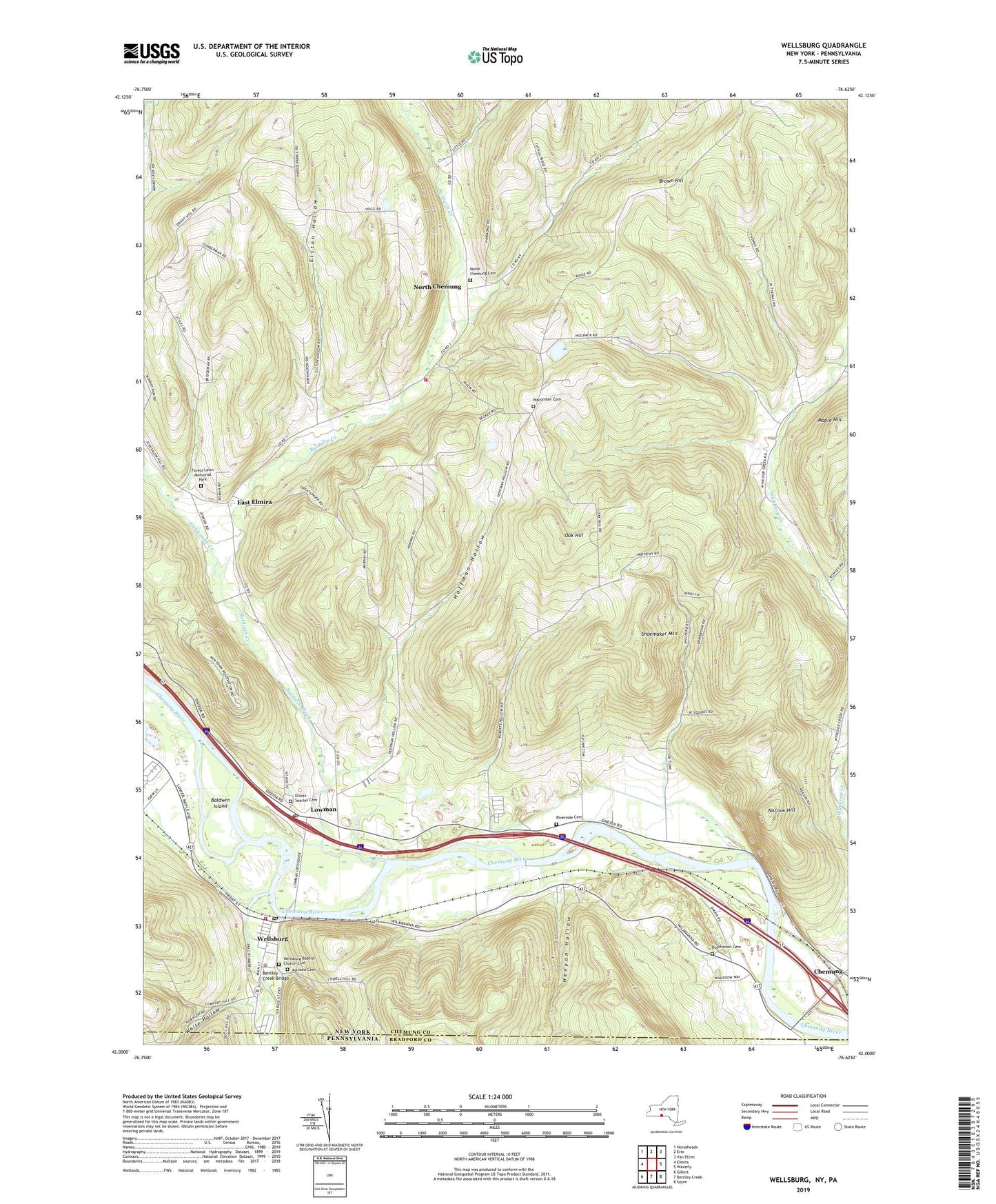
2019 topographic map quadrangle Wellsburg in the state of New York. Scale: 1:24000. Based on the newly updated USGS 7.5' US Topo map series, this map is in the following counties: Chemung, Bradford. The map contains contour data, water features, and other items you are used to seeing on USGS maps, but also has updated roads and other features. This is the next generation of topographic maps. Printed on high-quality waterproof paper with UV fade-resistant inks.
Quads adjacent to this one:
West: Elmira
Northwest: Horseheads
North: Erin
Northeast: Van Etten
East: Waverly
Southeast: Sayre
South: Bentley Creek
Southwest: Gillett
Contains the following named places: Ashland Cemetery, Baldwin Creek, Baldwin Island, Baldwin Volunteer Fire Company Station 1, Beantown, Bentley Creek, Bentley Creek Bridge, Birchland Park, Brown Hill, Carriage Estates, Chemung County Landfill, Dutchtown Cemetery, East Elmira, Elliott-Searles Cemetery, Elston Hollow, Forest Lawn Memorial Park, Foxwin Farm, Garner Hill Campground, Goldsmith Creek, Grace Farms, Henyon Hollow, Hoffman Hollow, Holly Park Terrace, Lowman, Lowman Post Office, Mallory Creek, Maple Hill, Millards Berry Farm, Narrow Hill, Newtown Battlefield Reservation, North Chemung, North Chemung Cemetery, North Chemung United Methodist Church, Oak Hill, Riverside Cemetery, Roberts Hollow, Shoemaker Mountain, Sly Creek, Town of Baldwin, Village of Wellsburg, Wacomber Cemetery, Wacombers Corners, Washburn Brook, Wellsburg, Wellsburg Baptist Church Cemetery, Wellsburg Post Office, Wellsburg United Methodist Church, Wellsburg Volunteer Fire Department, White Hollow, White Hollow Run, ZIP Codes: 14861, 14901