MyTopo
Van Etten New York US Topo Map
Couldn't load pickup availability
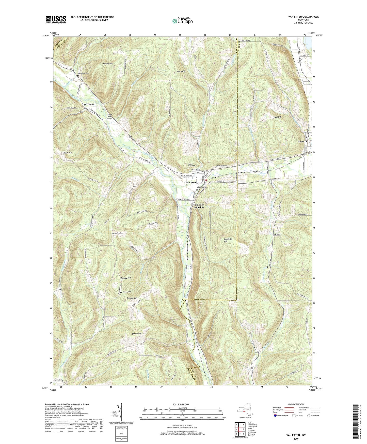
2023 topographic map quadrangle Van Etten in the state of New York. Scale: 1:24000. Based on the newly updated USGS 7.5' US Topo map series, this map is in the following counties: Chemung, Tioga, Schuyler. The map contains contour data, water features, and other items you are used to seeing on USGS maps, but also has updated roads and other features. This is the next generation of topographic maps. Printed on high-quality waterproof paper with UV fade-resistant inks.
Quads adjacent to this one:
West: Erin
Northwest: Alpine
North: West Danby
Northeast: Willseyville
East: Spencer
Southeast: Barton
South: Waverly
Southwest: Wellsburg
This map covers the same area as the classic USGS quad with code o42076b5.
Contains the following named places: Assembly of God Church, Baker Creek, Barnes Hill, Blake Hill, Burheight Creek, Canfield Memorial Cemetery, Cayuta Creek Bridge, Cooper Hill, Darling Creek, Doolittle Hill, Jenkins Cemetery, Johnson Creek, Langford Creek, McDuffy Creek, Mount Hope Cemetery, Nobles Hill, Rumsey Cemetery, Rumsey Hill, Saint Pius X Church, Spencer Lake, Spencer-Van Etten Elementary School, Spencer-Van Etten High School, Swartwood, Swartwood Cemetery, Town of Van Etten, Van Etten, Van Etten Census Designated Place, Van Etten Community United Church, Van Etten Junction, Van Etten Post Office, Van Etten Volunteer Fire Department, Village of Van Etten, West Hill, Westbrook Cemetery, ZIP Code: 14889