MyTopo
West Shokan New York US Topo Map
Couldn't load pickup availability
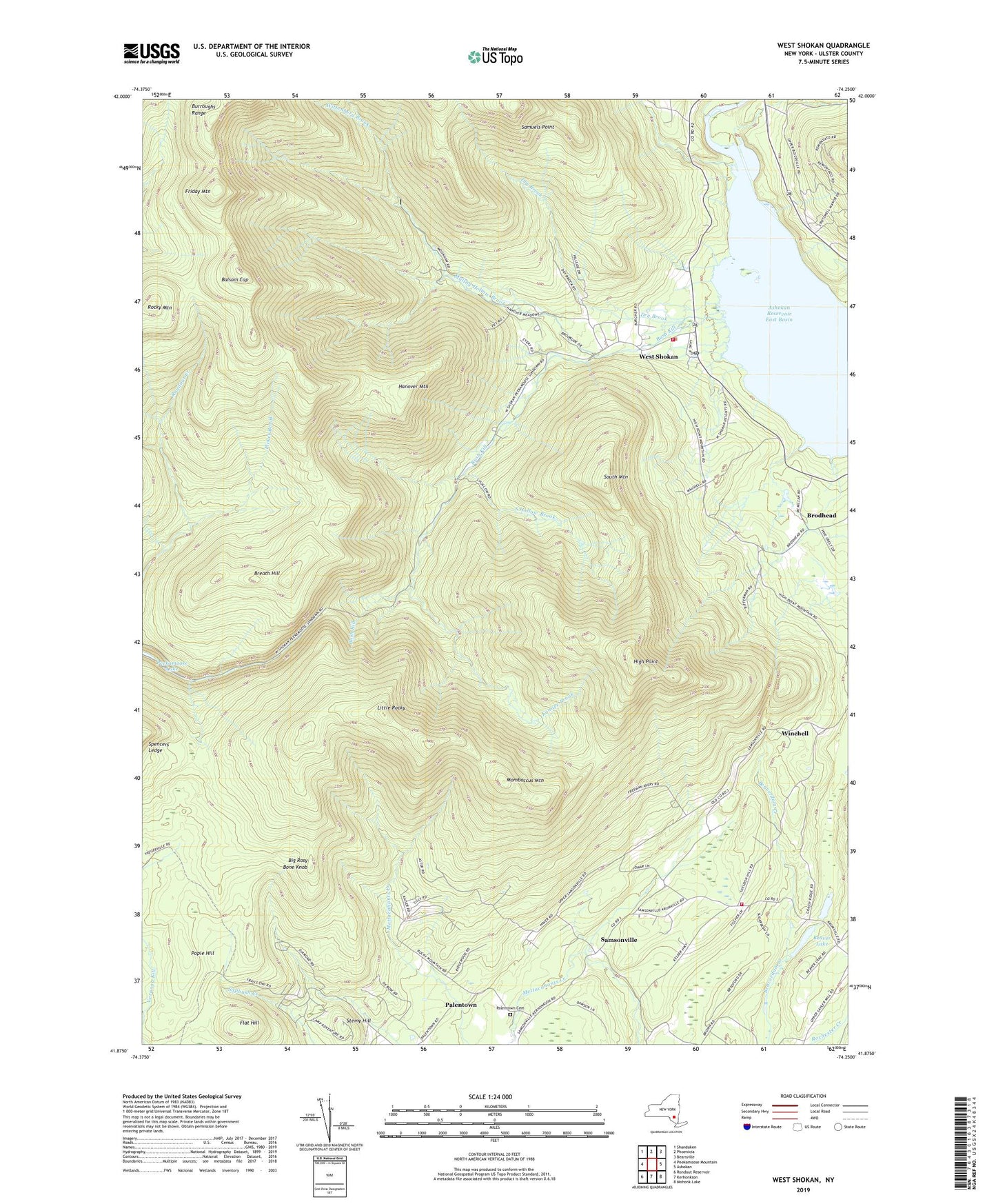
2019 topographic map quadrangle West Shokan in the state of New York. Scale: 1:24000. Based on the newly updated USGS 7.5' US Topo map series, this map is in the following counties: Ulster. The map contains contour data, water features, and other items you are used to seeing on USGS maps, but also has updated roads and other features. This is the next generation of topographic maps. Printed on high-quality waterproof paper with UV fade-resistant inks.
Quads adjacent to this one:
West: Peekamoose Mountain
Northwest: Shandaken
North: Phoenicia
Northeast: Bearsville
East: Ashokan
Southeast: Mohonk Lake
South: Kerhonkson
Southwest: Rondout Reservoir
Contains the following named places: Balsam Cap, Beaver Lake, Big Rosy Bone Knob, Breath Hill, Brodhead, Brodhead School, Bush Kill, Bushkill School, Dry Brook, Father Divine Lodge, Flat Hill, Friday Mountain, Hanover Mountain, High Point, Kanape Brook, Kanape Jeep Trail, Little Rocky, Maltby Hollow Brook, Mine Hollow, Mombaccus Mountain, Moonhaw Gun Club, Olive Free Library, Olive Volunteer Fire Department 1 Samsonville Company 4, Olive Volunteer Fire Department 1 West Shokan Company 3, Palentown, Palentown Cemetery, Picket Brook, Pople Hill, Rochester School, Rocky Mountain, Samsonville, Samsonville School, Samuels Point, South Hollow Brook, South Mountain, Spencers Ledge, Steiny Hill, Town of Olive, Traver Hollow, Ulster County, Vernooy Falls Trail, Watson Hollow, West Shokan, West Shokan Post Office, West Shokan School, Winchell, Winchell School, Wittenberg Brook, ZIP Codes: 12461, 12494