MyTopo
Ashokan New York US Topo Map
Couldn't load pickup availability
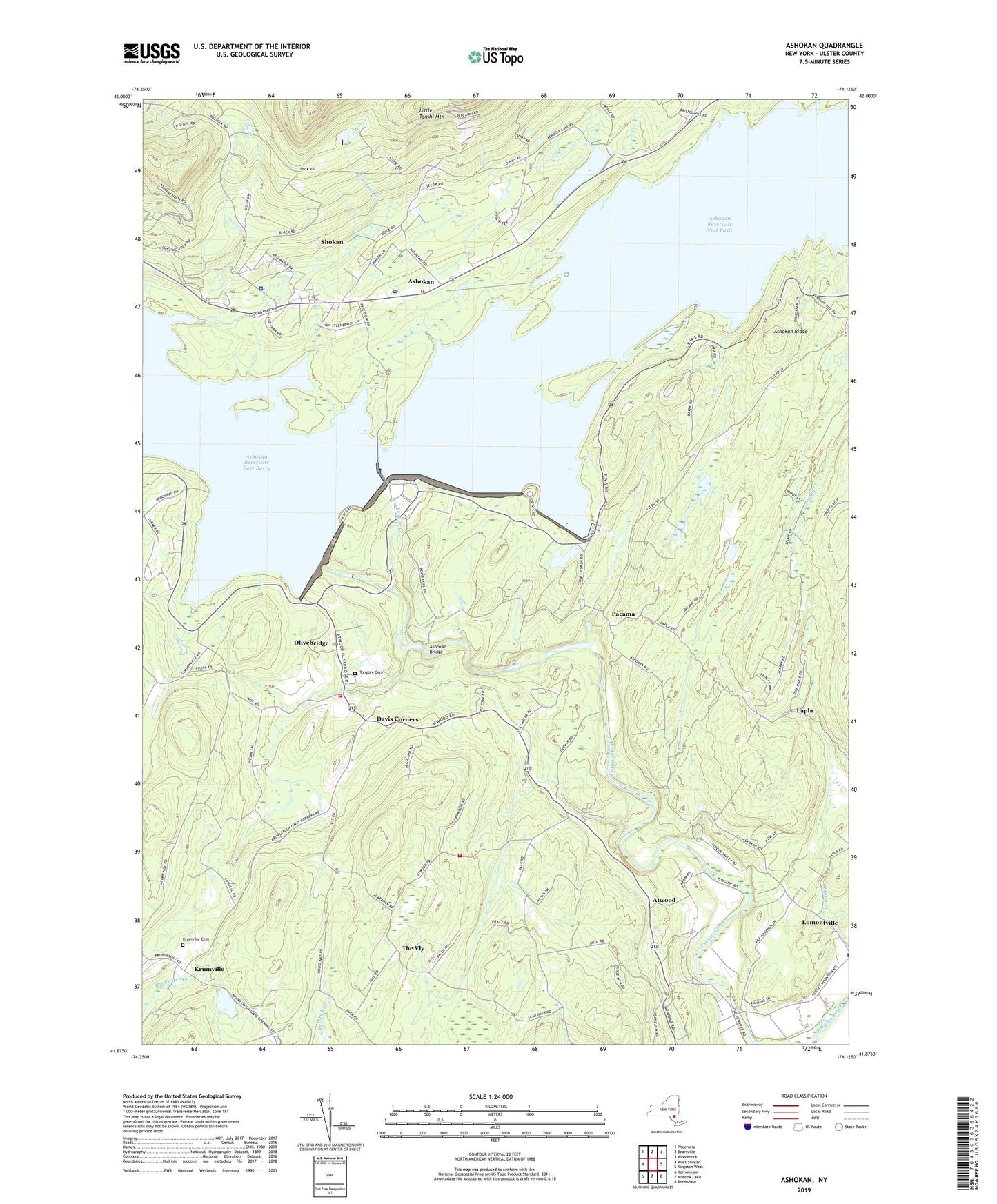
2023 topographic map quadrangle Ashokan in the state of New York. Scale: 1:24000. Based on the newly updated USGS 7.5' US Topo map series, this map is in the following counties: Ulster. The map contains contour data, water features, and other items you are used to seeing on USGS maps, but also has updated roads and other features. This is the next generation of topographic maps. Printed on high-quality waterproof paper with UV fade-resistant inks.
Quads adjacent to this one:
West: West Shokan
Northwest: Phoenicia
North: Bearsville
Northeast: Woodstock
East: Kingston West
Southeast: Rosendale
South: Mohonk Lake
Southwest: Kerhonkson
This map covers the same area as the classic USGS quad with code o41074h2.
Contains the following named places: Acorn Hill Church, Ashokam School, Ashokan, Ashokan Bridge, Ashokan Dam, Ashokan Reservoir, Ashokan Reservoir Aerator, Ashokan Reservoir East Basin, Ashokan Reservoir West Basin, Ashokan Ridge, Atwood, Atwood School, Butternut Creek, Camp High Point, Davis Corners, District 12 School, District 3 School, Hasbrouck Farms, Kenozia Lake, Krumville, Krumville Cemetery, Krumville School, Lapla, Little Tonshi Mountain, Lomontville, Lomontville Assembly of God, Lomontville School, Lower Spillway School, Olive Bridge School, Olive Volunteer Fire Department 1 Olivebridge Company 1, Olive Volunteer Fire Department 1 Shokan Company 2, Olivebridge, Olivebridge Post Office, Pacama, Shokan, Shokan Census Designated Place, Shokan Post Office, Spillway School, State University College at New Paltz Camp, Stone Ridge Heliport, The Vly, The Vly Chapel, Tongore Cemetery, Vly Atwood Volunteer Fire Company, Vly School, ZIP Codes: 12481, 12491