MyTopo
Willet New York US Topo Map
Couldn't load pickup availability
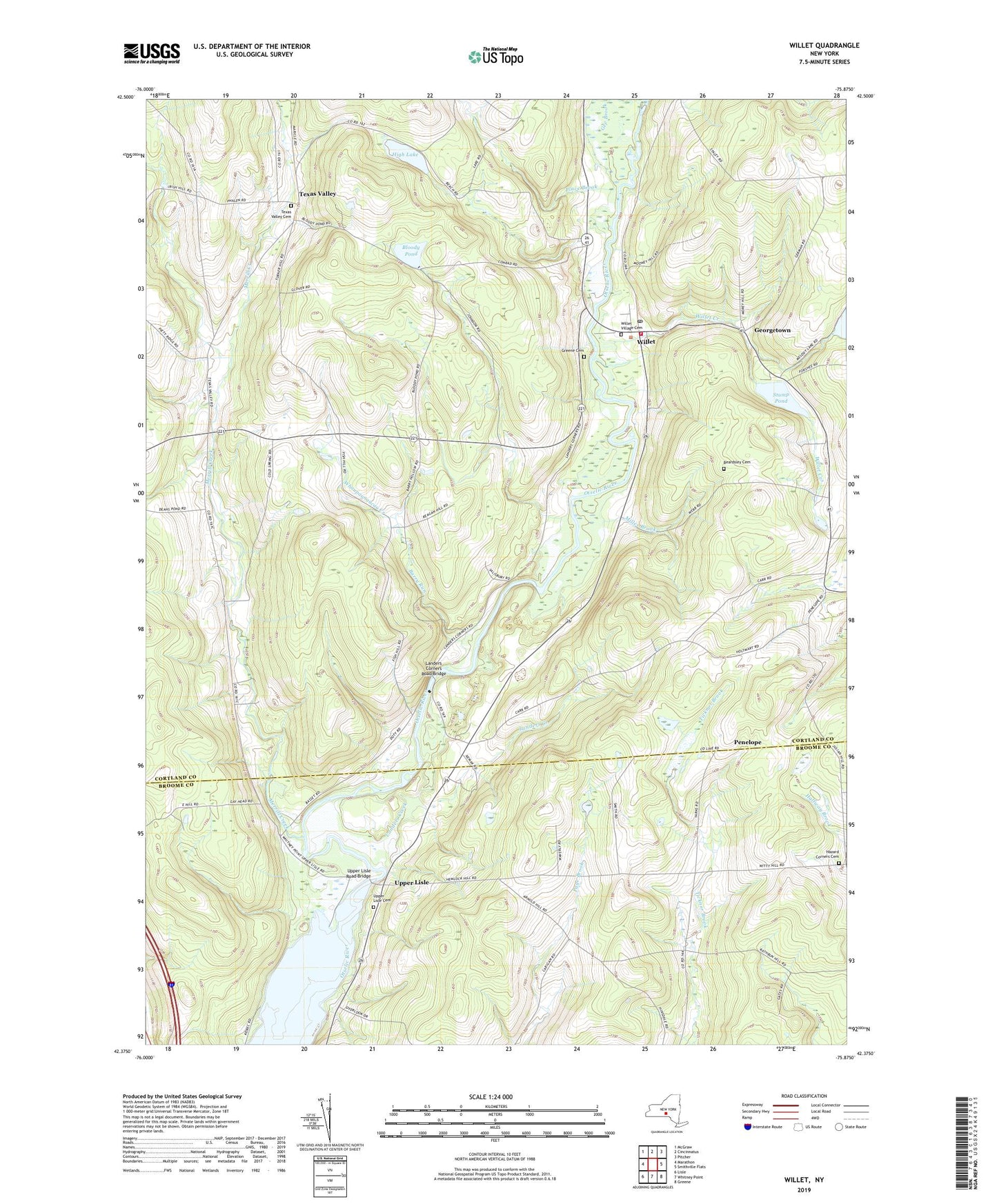
2019 topographic map quadrangle Willet in the state of New York. Scale: 1:24000. Based on the newly updated USGS 7.5' US Topo map series, this map is in the following counties: Cortland, Broome. The map contains contour data, water features, and other items you are used to seeing on USGS maps, but also has updated roads and other features. This is the next generation of topographic maps. Printed on high-quality waterproof paper with UV fade-resistant inks.
Quads adjacent to this one:
West: Marathon
Northwest: McGraw
North: Cincinnatus
Northeast: Pitcher
East: Smithville Flats
Southeast: Greene
South: Whitney Point
Southwest: Lisle
Contains the following named places: Barry Run, Beardsley Cemetery, Bloody Pond, Clough Corners, Gee Brook, Georgetown, Greene Cemetery, Hazard Corners Cemetery, Hazzard Corners, High Lake, Landers Corners, Landers Corners Road Bridge, Landers Creek, Merrill Creek, Miller Brook, Penelope, Place Brook, Stump Pond, Texas Valley, Texas Valley Cemetery, Town of Willet, Upper Lisle, Upper Lisle Cemetery, Upper Lisle Road Bridge, Whaupaunaucau Creek, Willet, Willet Creek, Willet Post Office, Willet Village Cemetery, Willet Volunteer Fire Department, ZIP Code: 13863