MyTopo
Greene New York US Topo Map
Couldn't load pickup availability
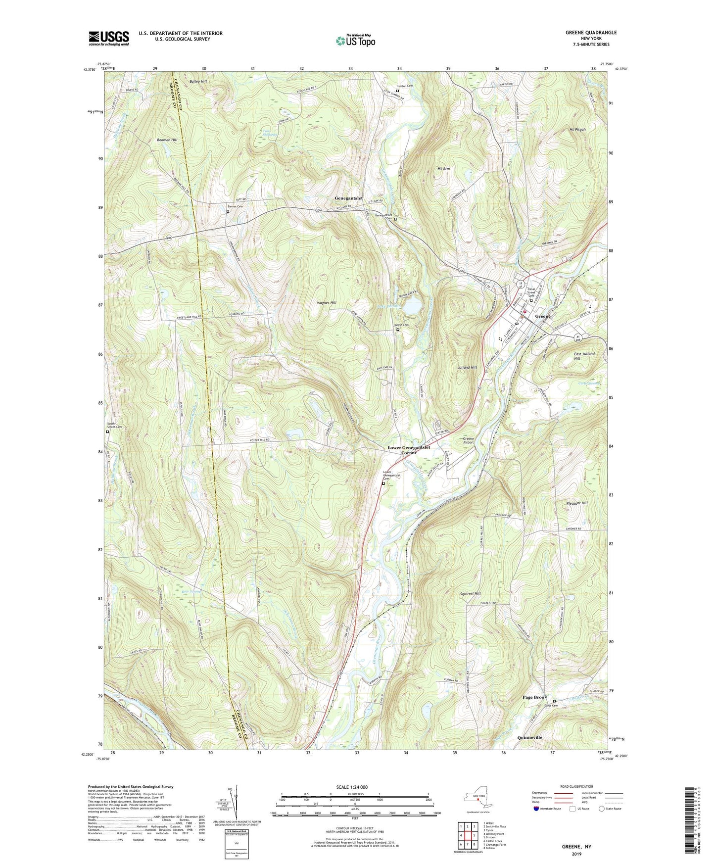
2023 topographic map quadrangle Greene in the state of New York. Scale: 1:24000. Based on the newly updated USGS 7.5' US Topo map series, this map is in the following counties: Chenango, Broome. The map contains contour data, water features, and other items you are used to seeing on USGS maps, but also has updated roads and other features. This is the next generation of topographic maps. Printed on high-quality waterproof paper with UV fade-resistant inks.
Quads adjacent to this one:
West: Whitney Point
Northwest: Willet
North: Smithville Flats
Northeast: Tyner
East: Brisben
Southeast: Belden
South: Chenango Forks
Southwest: Castle Creek
This map covers the same area as the classic USGS quad with code o42075c7.
Contains the following named places: Bailey Hill, Barnes Cemetery, Barnes Corners, Beaman Hill, Bear Swamp, Berean Bible Church, Birdsall Brook, Canal Street Cemetery, Central Baptist Church, Chalker Creek, Community Bible Fellowship, Curtis Swamp, East Juliand Hill, Elliot Cemetery, Fickles Corner, First Congregational Church, Genegantslet, Genegantslet Cemetery, Genegantslet Creek, Genegantslet Golf Club, Greene, Greene Airport, Greene Emergency Squad, Greene High School, Greene Intermediate School, Greene Middle School, Greene Post Office, Greene Primary School, Greene Village Hall, Greene Volunteer Fire Department, Horton Cemetery, Immaculate Conception Church, Indian Brook, Juliand Hill, Lake Petonia, Lower Genegantslet Cemetery, Lower Genegantslet Corner, Moore Memorial Library, Morse Cemetery, Mount Arm, Mount Pisgah, Ockerman Brook, Page Brook, Pinewoods Mobile Home Park, Pleasant Hill, South Street Cemetery, Squirrel Hill, The Church of Jesus Christ of Latter Day Saints, Town of Greene, Turk Slashings, United Methodist Church, Village of Greene, Wagner Hill, Zion Episcopal Church, ZIP Code: 13778