MyTopo
Barco North Carolina US Topo Map
Couldn't load pickup availability
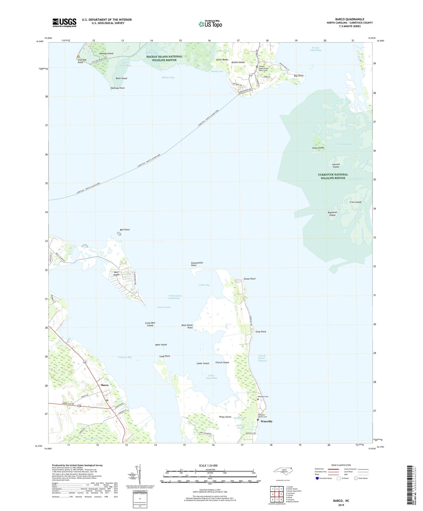
2019 topographic map quadrangle Barco in the state of North Carolina. Scale: 1:24000. Based on the newly updated USGS 7.5' US Topo map series, this map is in the following counties: Currituck. The map contains contour data, water features, and other items you are used to seeing on USGS maps, but also has updated roads and other features. This is the next generation of topographic maps. Printed on high-quality waterproof paper with UV fade-resistant inks.
Quads adjacent to this one:
West: Currituck
Northwest: Creeds
North: Knotts Island
Northeast: Knotts Island OE E
East: Corolla
Southeast: Mossey Islands
South: Coinjock
Southwest: Shiloh
Contains the following named places: Ballance Cemetery, Barco, Barco Post Office, Bay Point, Bell Island, Bell Point, Bellows Bay, Buck Island, Buck Island Bay, Cedar Bay, Cedar Island, Cedar Island Bay, Church Island, Church Island Channel, Claudia Capps Home Place Cemetery, Coinjock Bay, Coinjock Creek, Crow Island, Currituck Bay, Currituck National Wildlife Refuge, Goose Castle, Goose Point, Goosecastle Point, Gray Point, Great Hope Church, Halfway Point, Hampton Family Cemetery, Hampton Lodge, Hills Landing, Indian Creek, Indian Pond, Johnson Island, Knotts Island Ferry, Knotts Landing, Little Bell Island, Little Bellows Bay, Live Oak Point, Long Point, Mate Island, North Landing River, Parker Creek, Piney Island, Raymond Island, Sandy Cove, Sentara Nursing Center of Currituck, South Channel, Swan Island, Township of Fruitville, Waterlily, Wolf House Point, ZIP Codes: 27923, 27929