MyTopo
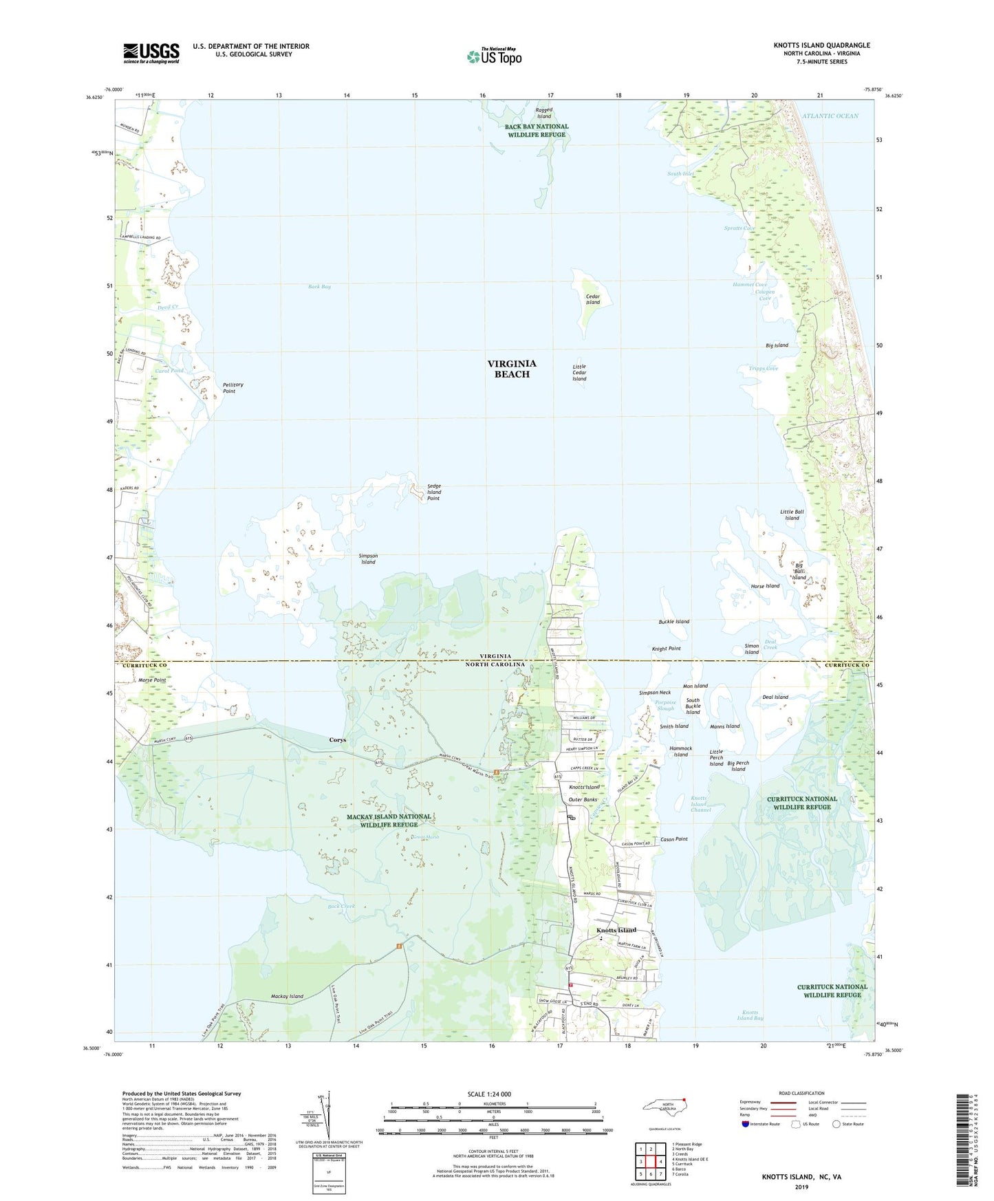
Knotts Island North Carolina US Topo Map
Couldn't load pickup availability
2022 topographic map quadrangle Knotts Island in the states of Virginia, North Carolina. Scale: 1:24000. Based on the newly updated USGS 7.5' US Topo map series, this map is in the following counties: Currituck, Virginia Beach (city). The map contains contour data, water features, and other items you are used to seeing on USGS maps, but also has updated roads and other features. This is the next generation of topographic maps. Printed on high-quality waterproof paper with UV fade-resistant inks.
Quads adjacent to this one:
West: Creeds
Northwest: Pleasant Ridge
North: North Bay
East: Knotts Island OE E
Southeast: Corolla
South: Barco
Southwest: Currituck
Contains the following named places: Back Bay, Back Creek, Barbours Hill Waterfowl Management Area, Big Ball Island, Big Island, Big Perch Island, Buckle Island, Campbells Landing, Capsies Creek, Carol Pond, Cason Point, Cedar Island, Corys, Cowpen Cove, Deal Creek, Deal Island, Devil Creek, False Cape, False Cape Coast Guard Station, False Cape Landing, False Cape State Park, Ferguson Mobile Home Park, Great Marsh, Hammet Cove, Hammock Island, Hemsath Mobile Home Park, Horse Island, Knight Point, Knotts Island, Knotts Island Baptist Church, Knotts Island Bay, Knotts Island Channel, Knotts Island Community Center, Knotts Island Elementary School, Knotts Island Post Office, Knotts Island Rescue Squad, Knotts Island Ruritan Park, Knotts Island United Methodist Church, Knotts Island Volunteer Fire Department, Little Ball Island, Little Cedar Island, Little Perch Island, Mackay Island, Mackay Island National Wildlife Refuge, Man Island, Manns Island, Mon Island, Morse Point, North End, North End School, Pellitory Point, Pocahontas Waterfowl Management Area, Porpoise Slough, Public Landing, Sedge Island Point, Simon Island, Simpson Island, Simpson Neck, Smith Island, South Buckle Island, South Inlet, Spratts Cove, Tripps Cove, Trojan Waterfowl Management Area, Woodleigh, ZIP Code: 27950