MyTopo
Creeds Virginia US Topo Map
Couldn't load pickup availability
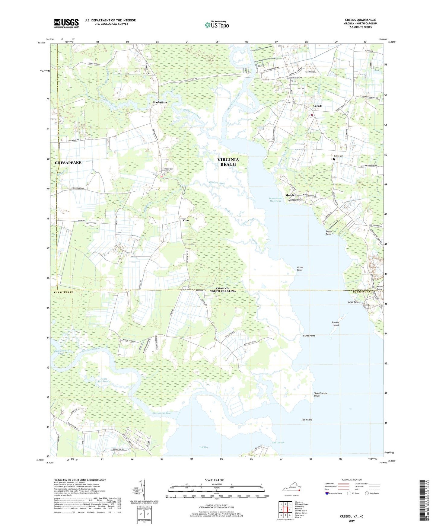
2022 topographic map quadrangle Creeds in the states of Virginia, North Carolina. Scale: 1:24000. Based on the newly updated USGS 7.5' US Topo map series, this map is in the following counties: Virginia Beach (city), Currituck, Chesapeake (city). The map contains contour data, water features, and other items you are used to seeing on USGS maps, but also has updated roads and other features. This is the next generation of topographic maps. Printed on high-quality waterproof paper with UV fade-resistant inks.
Quads adjacent to this one:
West: Moyock
Northwest: Fentress
North: Pleasant Ridge
Northeast: North Bay
East: Knotts Island
Southeast: Barco
South: Currituck
Southwest: Lambs Corner
This map covers the same area as the classic USGS quad with code o36076e1.
Contains the following named places: Bethel Cemetery, Bethel Church, Blackwater, Blackwater Cemetery, Blackwater Church, Blackwater Creek, Buck Island Pond, Cava Church, Creeds, Creeds Field, Creeds Heliport, Creeds School, Faraby Island, Gibbs Point, Gibbs Woods, Green Point, Greentown, Hog Island, Kala Church, Knight's Landing LLC Airport, Milldam Creek, Munden, Munden Point, Nellie Bell Ponds, Northwest River, Oak Grove Baptist Church, Oak Grove Cemetery, Oakum Creek, Peter Dozier Pond, Piney Grove Church, Pleasant Valley Church, Princess Anne Church, Pungo Ferry, Pungo Ferry Marina, Sandy Point, Slab Landing, Snake Creek, The Launch, Troublesome Point, Tull Bay, Vine, Virginia Beach Fire Department Station 13 Blackwater, Virginia Beach Fire Department Station 6 Creeds, Walke Point, Walnut Creek, ZIP Code: 23457