MyTopo
Broadway North Carolina US Topo Map
Couldn't load pickup availability
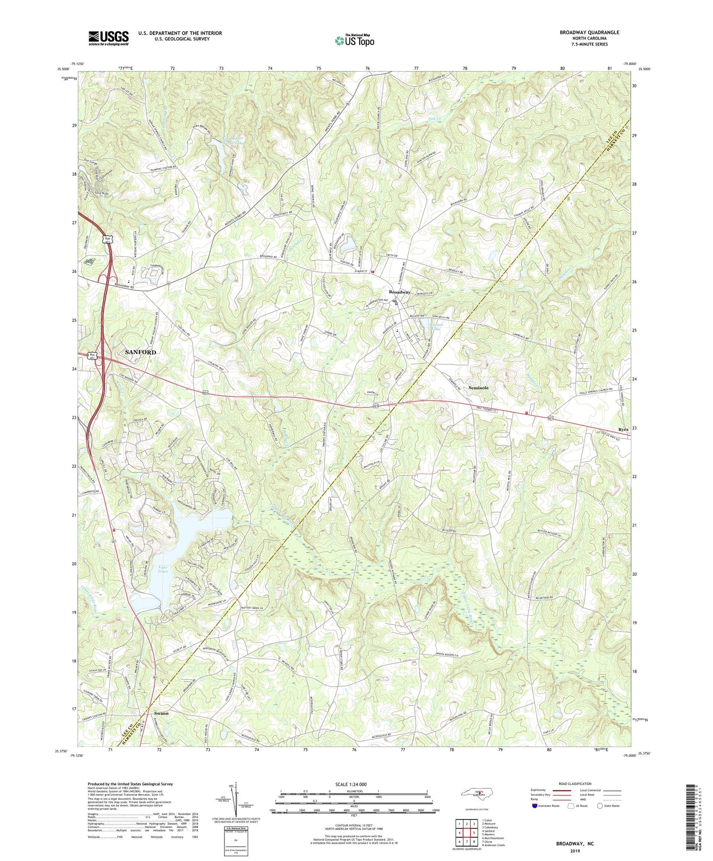
2019 topographic map quadrangle Broadway in the state of North Carolina. Scale: 1:24000. Based on the newly updated USGS 7.5' US Topo map series, this map is in the following counties: Lee, Harnett. The map contains contour data, water features, and other items you are used to seeing on USGS maps, but also has updated roads and other features. This is the next generation of topographic maps. Printed on high-quality waterproof paper with UV fade-resistant inks.
Quads adjacent to this one:
West: Sanford
Northwest: Colon
North: Moncure
Northeast: Cokesbury
East: Mamers
Southeast: Anderson Creek
South: Olivia
Southwest: Murchisontown
Contains the following named places: Boone Trail Emergency Services Station 2, Brickwood, Broadway, Broadway Elementary School, Broadway Police Department, Broadway Post Office, Cameron Grove Church, Cape Fear Rural Fire Department, Carolina Trace, Carolina Trace Country Club, Carolina Trace Volunteer Fire Department, Carrs Creek, City Water Works Lake, East Lee County Junior High School, Edgewater Estates, Holly Springs Church, James Hoover Johnson Pond, James Hoover Johnson Pond Dam, Jonesboro Elementary School, Juniper Creek, Juniper Springs Church, Lake Trace, Lake Trace Dam, Lake Williams, Lake Williams Dam, Love Grove Church, Morris Chapel, Mount Pisgah Church, Patchet Creek, Poplar Springs Church, Ryes, Salem Church, San-Lee Park Dams, Seminole, Shallow Well Church, Swann, Town of Broadway, Township 3-Cape Fear, Union Grove Church, Watson Lake, Watson Lake Dam, ZIP Code: 27505