MyTopo
Mamers North Carolina US Topo Map
Couldn't load pickup availability
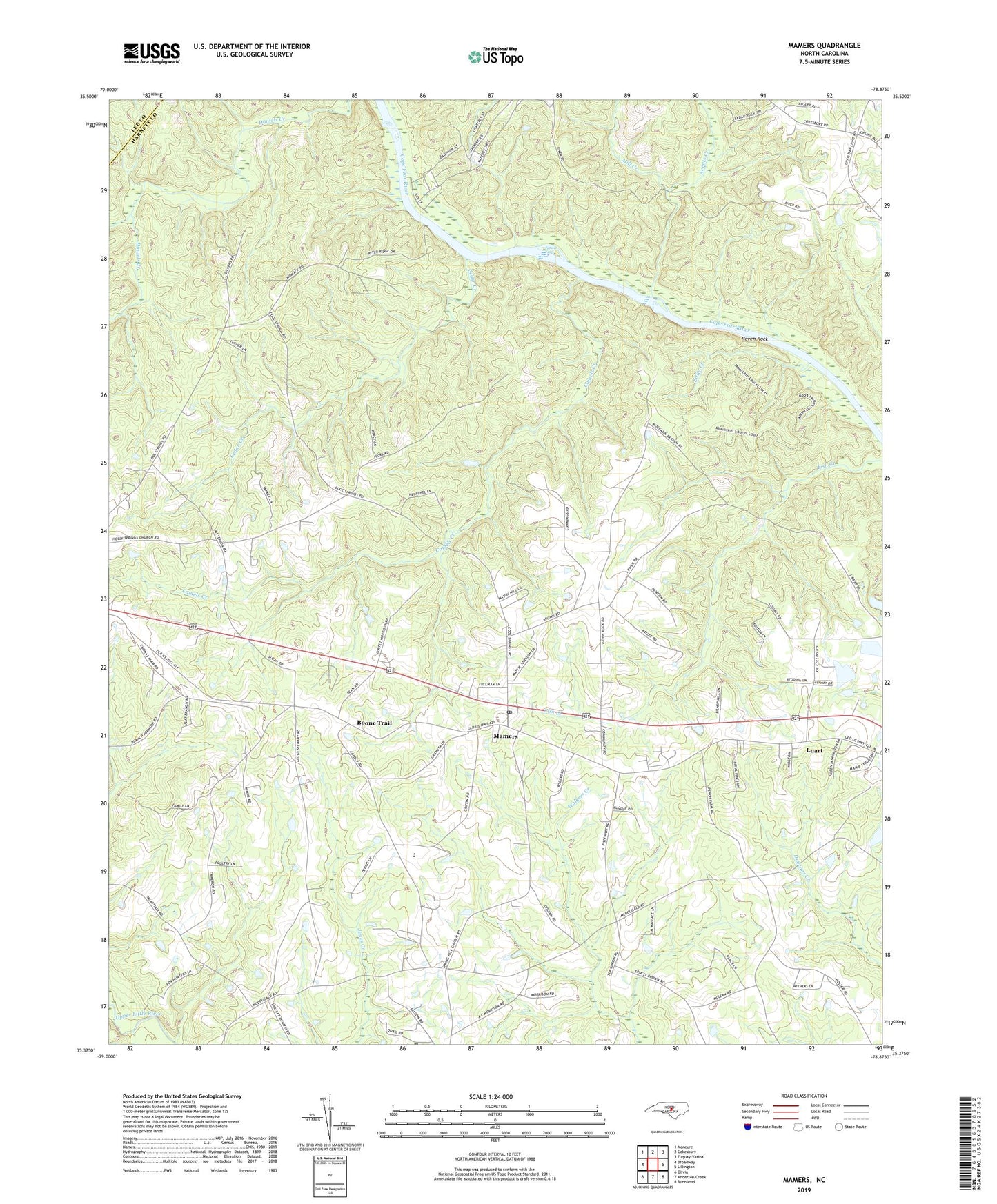
2022 topographic map quadrangle Mamers in the state of North Carolina. Scale: 1:24000. Based on the newly updated USGS 7.5' US Topo map series, this map is in the following counties: Harnett, Lee. The map contains contour data, water features, and other items you are used to seeing on USGS maps, but also has updated roads and other features. This is the next generation of topographic maps. Printed on high-quality waterproof paper with UV fade-resistant inks.
Quads adjacent to this one:
West: Broadway
Northwest: Moncure
North: Cokesbury
Northeast: Fuquay-Varina
East: Lillington
Southeast: Bunnlevel
South: Anderson Creek
Southwest: Olivia
This map covers the same area as the classic USGS quad with code o35078d8.
Contains the following named places: American Beech Trail, Antioch Church, Avents Creek, Boone Trail, Boone Trail Elementary School, Boone Trail Emergency Services, Camels Creek, Campbell Creek Loop, Cedar Creek, Chapel Hill Church, Cool Springs Church, East Loop Horse Trail, Ephesus Church, Fish Camp Trail, Group Camp Trail, Lanier Falls, Lanier Falls Trail, Leaflet Church, Little Creek, Little Creek Loop Trail, Luart, Mamers, Mamers Census Designated Place, Mamers Post Office, Mill Creek, Moore-Union Church, Northington Ferry Trail, Northington Lock and Dam, Paradise Church, Raven Rock, Raven Rock Church, Raven Rock Loop, Raven Rock State Park, Rogers Cemetery, Township of Upper Little River, West Loop Horse Trail, Woodside Church